Day 5: September 14. Crater Lake At Last
I was tempted to give the following Journal entry:
"Today, we bike around Crater Lake. Here are some pictures."
But... you really wouldn't get the full effect then, would you?
It starts out like this: today was billed as a lay-over day, with an optional trip around Crater Lake. On the map, the road goes 33 miles around the lake, affording views from all angles. And Crater Lake is billed as one of the Northwest's Biking Treasures, something you must put on your life list, like STP (one day, of course), a San Juan's tour, Ramrod, and (to us at least), the Courage Classic. Now, all of these are tough rides, cover over 150 miles, and can take a day or multiple days. Ramrod and Courage classic each cover over 10,000 feet of elevation gain, and more than 160 road miles. But for sheer audacity, nothing beats the road around the Lake.
To begin with, one has to go up to get there. From our night's digs, it was a 2000' climb, over 17 miles. After some initial posturing, we all loaded six singles and a tandem onto the SAG, and rode up together to the Rim Drive junction. Above the parking lot was the Rim itself, and just below that, a wall of thick pumice particles. Several of us raced up to get a first glimpse of the Lake, and found where the pumice came from - the air was flying by at 20-30 mph, right in our face. A mean, gusty, swirling South wind was blasting like a jet across the entire caldera containing Crater Lake. The sky was cloudless, the air temp probably 70 F, but I had to wear leggings and windbreaker. And for the first 6 miles, I frequently rode with my eyes closed, to keep the grit out of my contacts.
Then, there was the little thing with the hills. Oz, the cashier at the lodge, had said we'd encounter "a few rollers", but the route was basically flat. In actuality, the road varied from 6300' to 7600', over and over and over. Total elevation gain for the day was 3050 feet. The climbs were each a standard 6-7% grade, quite manageable under ordinary conditions. Heck, riding around our neck of the woods, the southern Gig Harbor peninsula, we routinely will cover 1000 vertical feet every ten miles.
But we do that in 100-300' chunks, not 600-1300'. And we do it at sea level, not 7000', where we lost 25% of our oxygen. (Lake level is 6100'.)
Despite - or, more probably, because of - the conditions, Leigh Cheryl, Craig and I enjoyed the day. In part because, like skiing, it involved going in circles (well, one big one), with nasty weather conditions, and periods of rest, followed by hard slogs against gravity, and attention to stability on the downhills. We noticed that it was a lot like mountain biking. Most of the downhill section were ridden next to road cut cliffs, with falling rocks gouging chucks out of the asphalt below our wheels. I've gone down some gravel roads smoother than what we encountered today, albeit with 40 psi tires.
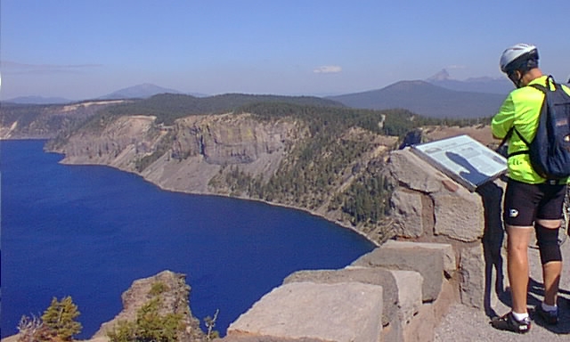
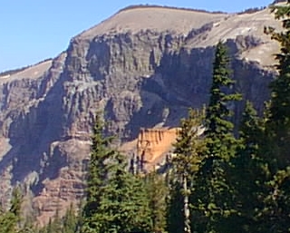
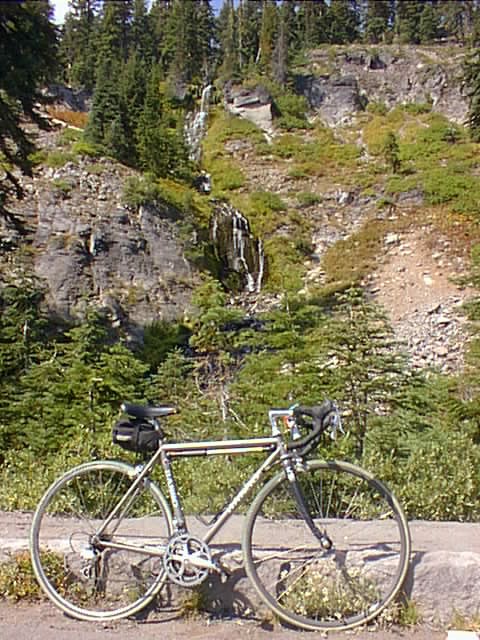
John had biked on ahead, Ken and Mike found the wind too dangerous on the tandem, and Dave took off immediately the opposite way from us, for a six mile ride to the lodge, and cappacino, and rest in a big comfy chair. So the four of us wound our way along the Rim, marveling at how one instant the place looked like Big Sur, the next like the Utah red rock desert, and then again like high alpine country around Mt. Rainier. I'll not detail the geology or scenery for you; go the the National Park web site if you're interested. Instead, here are some pictures:
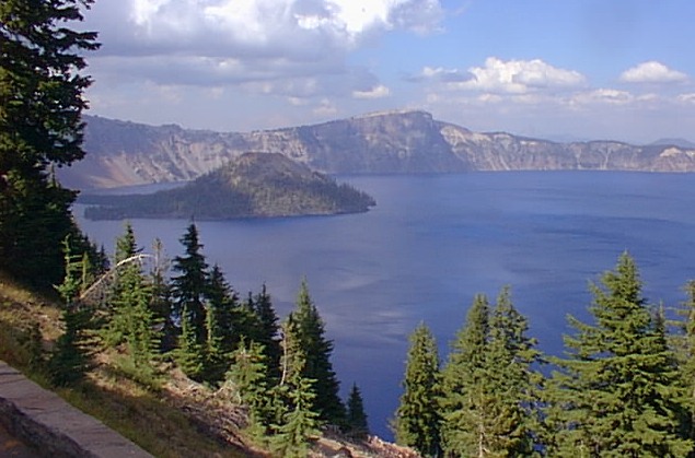
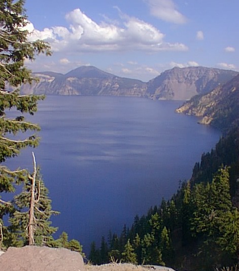
Cheryl's first view of the lake caused her to hold her head in wonder:
Craig became mesmerized by the deep blue of the lake:
More than once he stopped to gaze into its sublime depths:
Just after I told Cheryl of my longing to see Utah's Delicate Arch, this sight appeared:
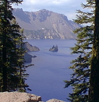
A jagged buttress juts into the water, called "Phantom Ship":
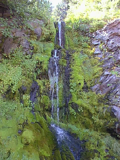
Water flows everywhere (OK one fascinating fact. The lake has no outlet, and only snow, rain, and the run down the rim walls to fill it up. It neither overflows, nor dries up. In fact, the water level remains remarkably constant, staying +/- 3 feet over recorded time. Evaporation and seepage equals precipitation and drainage. No reason this should happen, but the size of the caldera/crater, and the current climate are a perfect match for each other.) Here's Vidae Falls:
And an unnamed spring:
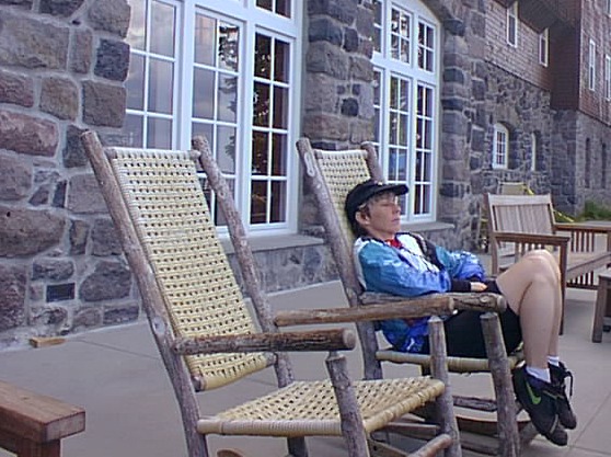
The lodge on the Rim, first built in 1917, was restored to year round service in the early nineties. Cheryl enjoyed a rest and the view from the oversize chairs:
And here's what she saw:
After one last climb, with the end nearly in sight, our last view of the Lake:
Miles: 37. Elevation gain 3050'. 60-70F, windy, cloudly in afternoon. Blackberry pie ala mode for dinner again.