The planes were getting progressively smaller, the flights progressively shorter, and the danger quotient geometrically higher. By the time we arrived at the Pokhara airport, I knew my fate was totally in the hands of either the Hindu gods or the Buddhist karmic wheel of life.
Pokhara to Jomsom is 150 kilometers via progressively narrower and more rutted roads. Google Maps will tell you it is a 4 hour, 30 minute drive “without traffic”. And that may be true. But, not for foreigners, who, due to local restrictions on taxi and bus service, must take at least three separate vehicles, all the while wondering whether the cliff-side of the road will hold up. So 9 hours is a more reasonable expectation. Hence the attraction of a 20 minute plane flight.
In theory, it should be a transcendent experience, flying along the southern edge of the Himalayas, towering 20,000 feet or more above the humid Nepalese lowlands. In reality, the only way through those peaks is via the narrow Kali Gandaki gorge. Pokhara is at 2200’, Jomsom at 8700’. So the entire flight, almost up to the moment of touchdown, is one long climb. The only time the flight is feasible is between 6 AM and 8 AM. Prior to that, it’s dark, and you risk slamming into a mountain. After that, the winds rushing up from steamy India make landing impossible. And sometimes, the planes doesn’t fly at all.
In either case – plane or jeep – we would have a much quicker trip than Michel Peissel in 1962, who needed 8 days to bring his caravan of horses into Jomsom, walking through jungled ridges and rock strewn river valleys.
And then there is the risk of dust clouds. From avalanches. A month earlier, the same flight encountered a sudden drop in visibility, forcing an immediate climb from 10,000’ to 13,000, smack into a forested snowy hillside. I tried not to think about that as the twin engine prop plane shuddered into life. A gaggle of French-Swiss trekkers crowded up front on the right side, hoping to get a glimpse of the Himal range. But only the very highest summits peeked over the brownish haze, blown up from India against the southern flanks.
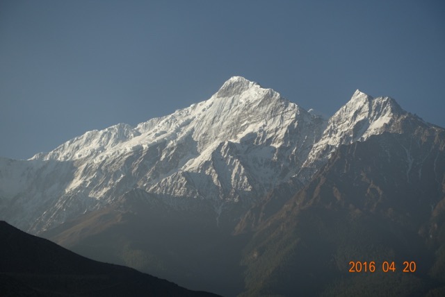
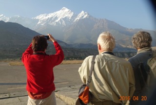
Shortly, though, on our left appeared Dhaulagiri, and on our right, Nil Giri, the western end of the Annapurna range. The haze was left behind, the wind not yet blowing. Crystal clear blue sky greeted us as we ducked through the plane door and gingerly downed a few steps to Jomsom’s tarmac. Mustang was in sight, and we started our trek through the looking-glass.


