Muktinath

carlifornia-1

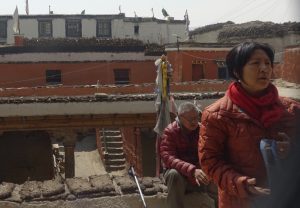
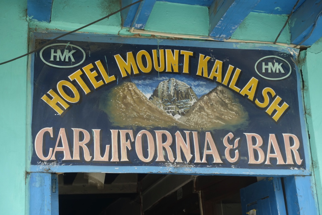
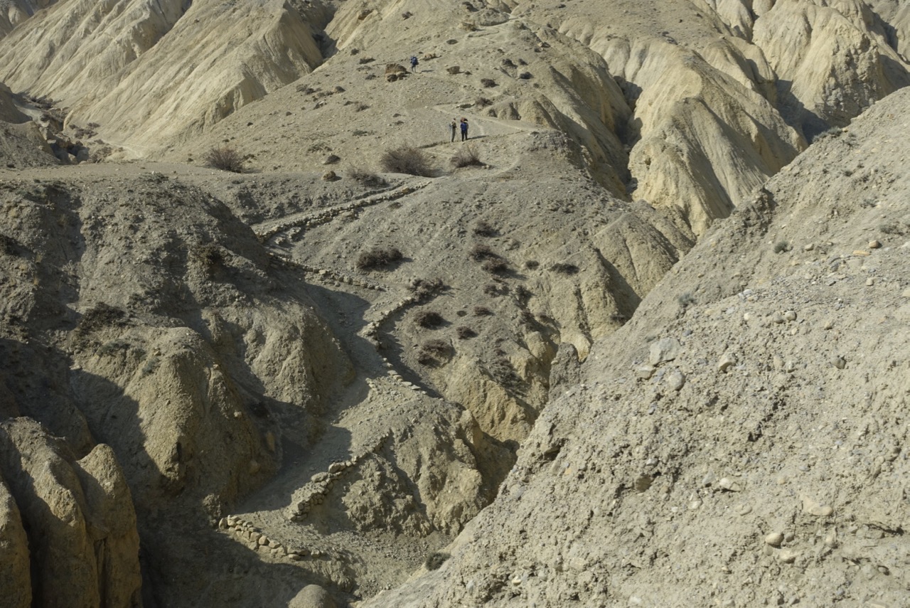
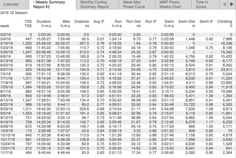
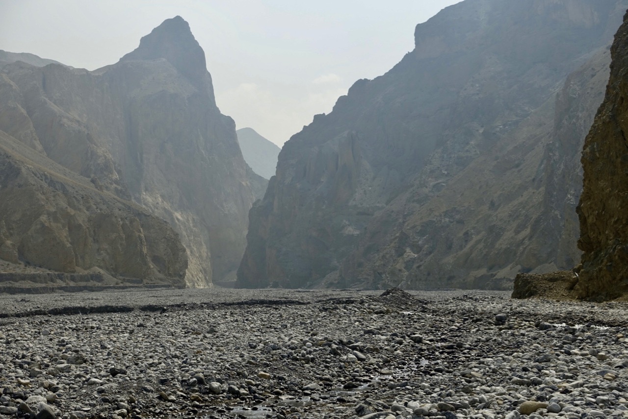
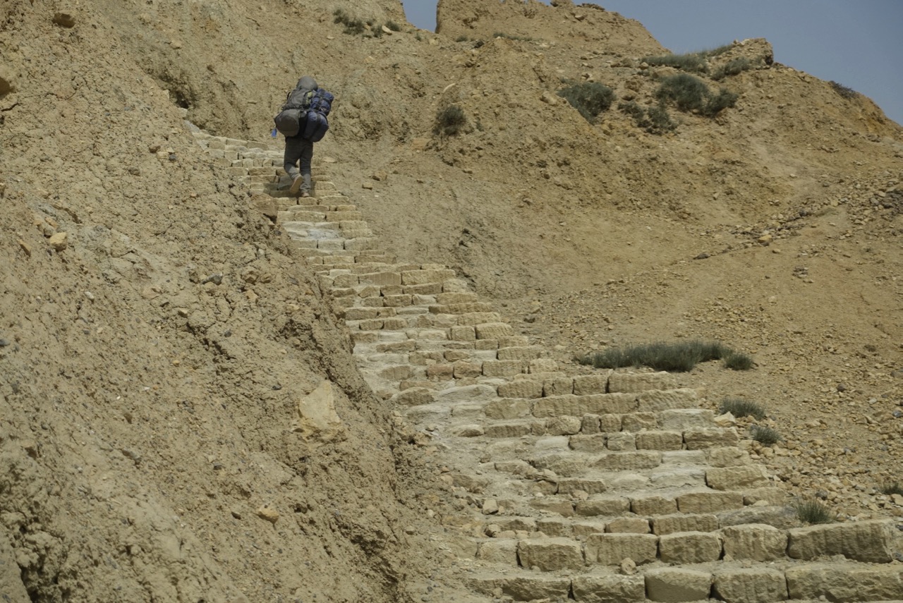
After our 16.5 mile trek across the high wastelands of the eastern Mustangi plateau, to Tetang, we spent the night in a spacious room with adjoining hot shower, well-prepared for the next day’s 2.5 hour walk back down the Kali Gandaki. Warmer air at the lower elevation invigorated our stroll, and we returned to Kagbeni at mid-day. The town which had seemed so primitive 12 days ago now seemed a bustling metropolis. With a day lopped off the schedule by our 10 hour slog from Tangge to Tetang, and our plane flight from Jomsom to Pokhara still two days in the future, we had some time to kill.

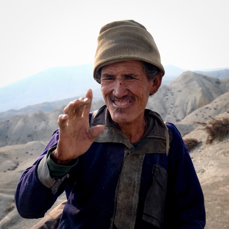
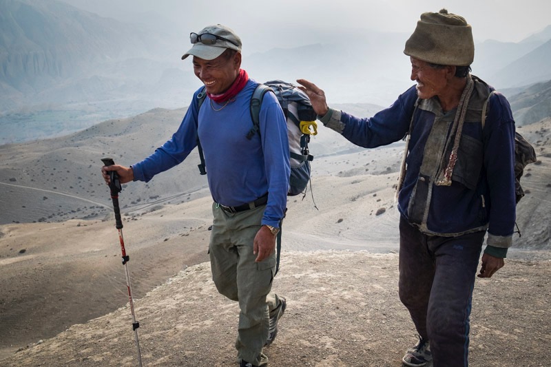
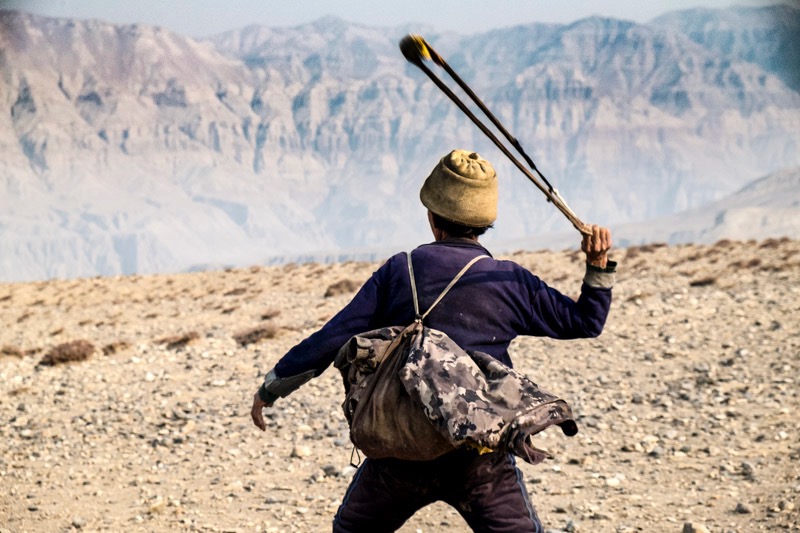
Kagbeni serves as a central roundhouse for travelers in four directions: south, to Jomsom, and thence to the outside world; west to Dolpo, an isolated valley renowned for its nomads; north, to Lo Manthang and the rest of Mustang; and east, to Muktinath. Since Dolpo offered more of the same scenery and culture we had just spent two weeks walking through, we decided to take a day hike to Muktinath, 7 miles up. This is a well trod pilgrim’s path for both Hindus and Tibetan Buddhists, as well as westerners following the Annapurna Circuit. We could have taken a jeep, horses, or even a helicopter, but we’d found a rhythm on our feet, and preferred to walk. Our porter, even though he had no load to carry, and could have taken a day off, wanted to come along, to see the sacred waters and flames.

Hinduism and Buddhism may encompass half of the world’s religious devotees, but they are both fairly opaque to me. So what little I’ve gathered about the sacred sites at Muktinath may be muddled, or worse. Meaning, take what I say here with a truckload of salt.

The following appears, almost word for word, in a number of websites I consulted about this place: “Buddhists call Muktinath Chumming Gyatsa, which in Tibetan means ‘Hundred Waters’. According to Tibetan Buddhism Chumig Gyatsa is a sacred place of the Dakinis goddesses known as Sky Dancers, and also one of the 24 celebrated Tantric places. Additionally, the site is believed to be a manifestation of Avalokitesvara, the Bodhisattva of Compassion and Virtue. The Tibetan Buddhist tradition states that Guru Rimpoche, also known as Padmasambhava, the founder of Tibetan Buddhism, meditated here on his way to Tibet.” That supposedly explains why Buddhists venerate the area.

The temple here is overseen by a Buddhist monk, with several nuns in residence to take care of the grounds and artifacts. Before entering the temple, we found three of them sitting below a chorten, washing each other’s hair. They seemed oblivious to being in a fish bowl with scores of Indian, Nepali (and two American) pilgrims gawking. Inside were the standard wall paintings, cupboards for sacred texts, and something different – the number one reason that Hindus come here.

The area is revered for the four major elements – fire, water, earth, sky (air) – being in close proximity. The fire, inside an earthen altar protected by chicken wire, looks for all the world like a pilot light on as gas stove. As it should, since the flame comes from natural gas leaking out of a coal seam underground. The nuns are charged with ensuring the flame does not go out. If only other religions could get it together with their sacred sites, say, in Jerusalem.

For Hindus, the following is apparently why they come here annually in the thousands: “Hindus call the site Mukti Kshetra, which literally means the “place of salvation” and it is one of the most ancient temples of the God Vishnu and the Vaishnava tradition in Nepal. The shrine is considered to be one of the eight sacred places known as Svayam Vyakta Ksetras (the other seven being Srirangam, Srimushnam, Tirupati, Naimisharanya, Totadri, Pushkar and Badrinath), as well as one of the 108 Divya Desam, or holy places of worship of Lord Vishnu. Additionally, it is also one of the 51 Shakti Pitha goddess sites.”

That number 108 carries a lot of weight here. Another stop along the route are the 108 spouts of freezing water, coming from sacred natural springs (presumably 108 of them) and carried into a concrete wall with 108 outflow pipes. Watching people coming through here, everyone seemed to have a different method. Some went clockwise, others, counter. Some just touched their fingers to each stream, others filled a plastic soft drink bottle with a few drops from each; some splashed water on their faces, and others, shirtless, took a full shower beneath each. There were also two small pools out front, mingling all 108 streams. Some people dipped their hands in, others walked through, and a few, again shirtless, did a semi-self-baptism.

In the center was a ladies’ only area. Oddly, it was open to view from above, and it seemed to be a place for grandmothers to light incense and gossip. Outside, two smartly dressed young Indian women took selfies and snapshots of each other, posing suggestively in the center of it all, ready for a Facebook post, “I was here!” The mixing of the sacred and profane was everywhere; there seemed to be no demarcation, as we’d find in western traditions, between what is religious practice, and standard fun-seeking. It was as if Catholics were walking right up to and through a cathedral altar, without crossing themselves or covering their heads if they were women.

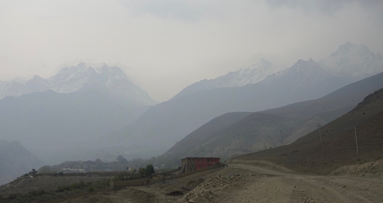
The physical setting for all this was, of course, breath-taking. Not only were we at 12,500’ altitude, but the Himalayas rose sharply above us, with the fabled route to Thorong La just five miles and over 5,000’ above us. I felt safe and warm “down” in Muktinath, compared to the risk of frostbite, storms, and altitude sickness which threatened the trekkers on the Annapurna circuit. Maybe in another life?

thorong-la-1

Posted in Mustang, Travelogues | 2 Comments

The Longest Day

swissgunbryce-1

“I only find one horse, for Cheryl,” Chaim announced at breakfast. “Al, you are OK walking? Maybe we go 9, 10 hours today?”

That was just fine with me. I was surprised by how vigorous I felt after ten days of trekking up and down the barren river gorges of Upper Mustang. I was no longer aware that our elevation had been around 3800 meters (12,467’, basically same as the high point at my Snowmass ski area, the top of the Cirque lift). Despite a broken toe five weeks earlier, I had no pain, no hitch in my giddy-up from walking about eight to ten miles each day. And I certainly wasn’t bored. I was getting into it, really, sort of like training for an Ironman, and today would be the final test. From the map, it looked like at least 14 miles, reaching the high point of the trip, 4260 meters (about 14,000’, nearly the summit of Mt. Rainier.) I was raring to go.

Cheryl would not be riding the whole way. The horse man would meet us at the base of theirrigation-channel-1 
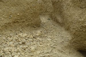
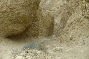
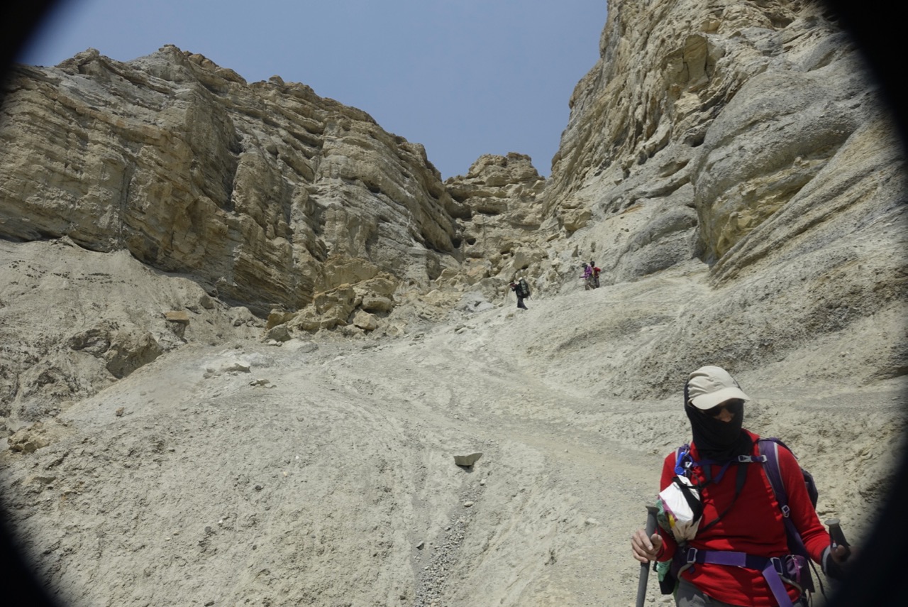
first climb, about a mile up the river gorge. First we followed a narrow line of green gouged into the hillside out of town – the hand-dug irrigation ditch, bringing water’s life-blood into Tangge. Unlined, the water seeped into the adjacent soil, and vibrant little plants followed its course all the way from the high glacier runoff.

Looking down to our left, I saw one of those rickety plank bridges across the river. A replaced-bridge-1shadow arced just beyond it, with two figures shimmying along – the Spanish couple crossing high above on a narrow suspension bridge. A good reason for the horse not to take us right out of town. The other good reason was the equine effort involved in simply carrying Cheryl’s 50 kilos (the horseman took her pack) up the mountain side. Apparently the little pony needed all the energy he could spare for that. The route was as unforgiving as any we’d steep-trail-1done thus far. Not exactly straight up the hill, but close enough. At least the locals had differentiated the human route from all the goat paths with rocks marking the edge of the trail.

It became obvious why the day would be so long. No villages at all in this part of Mustang. The small outpost of “Pa” proved to be a simple stone hut, uninhabited, next to the only water source we’d see all day. Nomads camped in the stony field below, their canvas tents darkened by the sun. Neither they nor their herd was in sight while we stopped for a morning do-it-yourself tea, meaning gatorade and nuts for me.

nomad-tents-1-2

I walked 2600′ in 3 miles uphill; it took me two hours. Resting at the La, I saw Cheryl on her pony, bobbing along below. Ten steps, rest. Eight Steps, rest again. The horse was having issues with the altitude and cargo, and insisted on taking his own sweet time. Cheryl was laughing at the pony, pleased with his instinctive self-preservation.

Next came 8 miles across an arid, expansive plateau. At times we clung to the edge of a knife ridge, looking down and across to our left at the high peaks of the Nepalese/Tibetan border. The view in that direction seemed to mimic, at its very top, an Alpine panorama, leading down into the Black Canyon of the Gunnison, ending with a simulacrum of Bryce Canyon. The other side, the one we were walking across, had portions where the trail disappeared into a treacherous scree field. Cheryl and I took our sweet time getting through that stretch, as one slip meant a fall of about 1500′ through a jagged rock field. Chaim brought up the rear, ready to snatch his client from any danger she might tumble into.

The plateau, when it wasn’t scaring us silly with its drop-offs, provided a complete view of the entire Upper Mustang canyon lands. It was fun picking out the vague green patches surrounding the towns we’d been through on the other side of the Kali Gandaki, the week before. The previous night’s snow fall added luster to the high peaks on the Tibetan border ridges. On the other side, a vista of badland fins and deep canyons concentrated my mind on the steps I took.

I kept expecting the trail to start its descent, but that was all wishful thinking. Around every bend was another; after every little rise a brief downhill, then back up again. Finally, the trail seemed to end in another maze of hoodoos and fins. Two gullies presented themselves; one must be the trail, the other simply a gash in the hillside. Both were filled with gravel, pebbles, and small rock, covered in “mud”,  which is what Chaim called the ever-present dust. I was stumped, and found it impossible to decide which was the trail and which might lead to a precipitous drop-off. Could you choose between these two?which-way-1-1which-way-1


To end our day, we dropped down 3000′ in 3.5 miles, much of it taken “slowly, slowly”, making sure of our purchase on each and every step, leaning on both trekking poles, for fear of sliding through the pebbly dust. But we made it to Tangge, arriving at what turned out to be a familiar tea house. Our second day out, we had stopped for lunch at this same two story stone lodge, set beside a stream with full-leafed trees. We had not noticed the building out back, where that night we would find our first indoor hot water shower in nearly two weeks.

tangge-1


Posted in Mustang, Travelogues | 3 Comments

Out With The Old, In With The New

[copy of a post to EN Forum today]

The intent of this thread is to encourage folks to review their past year in training and racing, and report goals for the coming year. Not intended as simply a summary of race performances, but rather analyses of what worked, what didn’t, what might be changed, and what might be committed to for 2017. I guess I’ll have to go first?

2016 season – roughly defined as Dec ’15 >> Nov ’16 – cleanly splits in half for me. Recovery from surgery (hernia), skiing, dealing with the implications of a broken big toe in February, and gone for 3+ weeks trekking in Nepal in April all put a pretty big hole in opportunities for improvement via consistent training. Comparing the first six months to the last via one metric, distance covered, I biked 1150/3700 miles, swam 70/152 km, and ran 175/632 miles. Looking back, I can see that “break” allowed my overworked triathlon head space and broken-down body a chance to do some healing. Having done about 30 IMs 2000-2015, I committed going forward to doing at most one per year (with the possible exception of aging up @ 70). I felt my increasingly narrowed athletic focus (I called it being on the Kona Merry-go-Round) was becoming unhealthy, and I wanted to create opportunities to strike out and do a few different things.

I wasn’t going to suddenly become a power lifter or soccer player; having fun with my fitness would likely remain in the areas I’d already carved out: skiing, hiking, swimming, cycling, running, and triathlon. I’m happy with how that turned out this year: skiing more days than I have since 1980, going for a two week trek half-way around the world, sharing my home in Colorado with a dozen EN tri freaks, and competing at the national level in shorter USAT races. The only thing I didn’t check off was getting back to mountain biking.

I was quite satisfied with how I performed in all my races: they were all fun, I achieved the time goals I set for myself, and I didn’t slow down at the end of any. But either from the more rapid fall off in speed that comes after age 60-65, or from the decreased emphasis on year-round training, I only won a couple of local tris, even coming in second in my local HM.

Since we’re primarily a triathlon team, which has a strong data-geek leaning, I’ll present a couple of charts, both covering my second season, 5/8 >> 11/13. First is my Performance Management Chart, PMC. It shows a steep rise in Acute Training Load starting with the EN Tour of California, and my Aspen training camp, a dip in early August for the USAT NC, then a plateau to a Chronic Training Load of 134 for several weeks in mid-Sept, in the ramp up to IM Maryland. The last six weeks reflect a drop to half iron training loads for the USAT LC (1/2 Iron) NC. IO placed 4th in both those races. Respectable, but not spectacular.

2016-pmc-1-1

Next, my weekly totals, first in graphic form, then a more detailed chart:

2016-pmc-1 2016-weekly-1

So, what about goals for the coming season. I like the direction this one took, so I’ll try a reprise. Dec-Jan, emphasis on skiing, but also work the OS in, taking 20 weeks to do what most of you get done in 14. Then, a few weeks of bike focus, getting ready for a Big Event, a trans-island bike tour of Cuba with my wife Cheryl. 17 days (11 biking), maybe 5-600 miles, with a Canadian guy who’s been doing these tours for 15+ years. We’ll have a cultural guide, mechanic, SAG driver, and two bike leaders. I think it will be both as ambitious and as rewarding as our trip to Nepal this year.

Then, the EN Blue Ridge Camp end of April. I head to Colorado May 15-June 22 or so, featuring a reprise of the “Al T ‘Tude” camp I hosted this year, June 4-11. Coeur d’Alene 70.3 June 26. Play Super Sherpa for an EN crew @ IM Lake Place in July. August features my A race for the year, the ITU Long Course (4k swim, 120k bike, 30k run) World Championships in Penticton, BC. September will feature a Fall Al T ‘Tude camp (watch for announcement early next year), and I’ll close the season with a Fall IM, still TBD among Louisville, Los Cabos, or Cozumel. I won’t sign up until next Spring, as I’m done playing WTC’s sign up a year in advance game.

My biggest goal for the year is a negative one: Don’t Get Injured. I’ve been doing too much of that the past decade, and Having Fun With Your Fitness requires being fit to begin with. Being injured puts a big crimp in that. Next, process goals of not getting slower or weaker in S/B/R, in order to (outcome goals): win CDA 70.3, and finish top 5 in Penticton.

Posted in Uncategorized | Comments Off on Out With The Old, In With The New

Man Cave/Cave Man


goat-herder-1

Leaving Yara, we face 26 miles of walking with 10,000 feet of elevation gain, with only one tea house lodge along the way. Trekkers supported by a full porter team, who are camping out each night, manage this in three days. We’re faced with doing it in two days. A lot of walking, a lot of climbing, and very little air; we’ll reach our high point of 4280 meters, about the height of Mt. Rainier in our backyard at home.

zion-gorge-1

As usual, we start out walking down to a river gorge, then 1000 meters up a gravelly hillside to a plateau. Arriving at the top, Chaim points to a herd of goats, saying, “I know this guy.” He says that a lot; Chaim seems to know half of Mustang.

The goat herder is grizzled, nearly toothless, squinty eyed, and smiling through a crinkly face, creased around his eyes, across his cheeks and forehead. He has a ratty wool watch cap, a shoulder bag, and a looped short rope around his neck.

Cheryl is curious, and wants to talk with the goat herder, so she gets Chaim to translate.goat-herder-2 Once they agree on a common language and dialect, it goes something like this:

“Where is he from?” We’re an hour or two into our day’s trek at this point. There has been no building, much less people, during that whole time.

“He come from Yara.”

“What does he do up here?”

“He bring the goat up every day. Some place different every day.”

“How old is he?”

“He say he about, um, let me see, 55.”

“Does he do anything else except herd goats?”

“He been doing this all his life.”

“Does he like his work.”

“He say, Oh Yes, it keep him busy, and he doesn’t deal with people.”

“What does he do for the goats?”

“Sometime, the goat get away, he has to bring them back.”

“How does he do that?”

“He has a sling shot. He throw a rock at goat, the goat come back.”

“Can he show me that. Can he use the sling shot?”

Chaim laughs. There are no stray goats to corral. But the herder points at a rock about 100 meters away. He picks up a small kiwi-size stone, slips it into a pouch in the middle of the rope he takes from his neck, whirls it a few times overhead, and flings. The small projectile arcs away, hitting the target square on with a distant thunk.

goat-herder-3

Cheryl laughs, smiles, and gets her pictures. Reaching the steep portion of the day’s first La, I forge ahead of our porter, only lightly encumbered by my day pack. I catch up to a Spanish couple we have been yo-yoing with for the past two days. They are camping, and we will part ways with them shortly, as they head off onto the Damodar Kunda Trek, an offshoot of the Annapurna Circuit. They will be walking up into glacier country, peaking at about 5800 meters. A bit jealous of their young adventurous souls and bodies, I wait with them at the La, the morning still calm, while Cheryl catches up.

We start downhill, and soon hit a broad open slope of stones, gravel and scree, across which the trail winds and switchbacks. I check my GPS watch for the elevation and gradient. Heading straight down, it’s 40%, with 25-30% being the incline between switchbacks. When it “flattens” out to 10%, I stop again, seeing first Cheryl, then Chaim, then the porters, who are running down the loose gravel slope, 65 pound packs held in place only by a strap around their necks. I had carefully inched my way down this slope, measuring every step, leaning on my hiking poles, not wanting to have my feet slide out from under me.

Down at the river, the channel has been altered to hug the far side of the bed, allowing an irrigation channel to siphon off the flow onto a plateau just below. Nothing is planted there yet, no sign of farming. Chaim points to the single building up on the bank.

irrigation-1

“That a new tea house. People here start to farm, so they have food next year. Now, we eat morning tea and rest.”

And go uphill once again, 800 meters in a couple of miles. By the time we reach the top, the wind has started its afternoon blast. We drop down into the inevitable fluted slot canyon, where the funnel effect has taken full force. Cheryl’s Tyvek jacket, whipping at the sleeves, is plastered to her chest, and her face is hidden from the stinging sand by her ever-present Buff.

Out of the slot, we look down on a broad mile-long plain to the final downhill plunge. I’m in the lead, and while I can clearly see a trail etched across the mesa, finding it at first is problematic, as the goats seem to not have cared where they went, and twenty or more squiggly routes present themselves. At the final drop off down into Tangge, our destination for the night, the prayer flags are especially busy, carrying the wind from the village up the ridge.

When Michel Peissel visited Tangge in the ‘60s, he was swarmed by townsfolk, who wanted to know his opinion of their chorten(s). They were sure they had the best, largest, and most impressive chorten anywhere in Mustang. Knowing that he had visited all the hamlets oin the upper Kali Gandaki basin, they would not let him into town until he admitted that, yes, their was certainly the most impressive. It features a multitude of domes (Peissel claims there were 30 during his visit; I could only count half that many.)

Tangge’s red and white chorten complex anchors the village, which sits just above its fields, hugging the cliff base. Wind has scoured out a natural Mt. Rushmore, with an ominous brooding face staring down across a crumbling ancient dzong, channeling an Easter Island statue.

cave-man-1

Our tea house was newly built, on the far end of town. Exploring the ruined dzong, I climb above our lodgings for an evening view. Clouds, dark not fluffy, roam overhead, and it sure does look like snow. Inside, the wood fire warms our transnational crew, Swiss, French, Spanish, and us, along with the Mustangis and Nepali guides and porters. Solar heated hot water awaits for those bold enough to brave the outside shower.

That night, the wind howls up the river canyon, unusual after dark. When we gather for the morning load-out, the snow line has indeed dropped down a lot, and the air has freshened up, the omni-present dust for once not obscuring views.

snowy-morning-1

Posted in Mustang, Travelogues | 1 Comment

Hole In The Wall Gang

luri-gompa-1-1

Like cathedrals in Europe, the locals think we are fascinated by every one of their monasteries. The interiors are all the same, the decorations and layouts just a variation on a theme. But how many cathedrals are housed in a cave? Yes, we’d seen another cave Gompa in Garphu/Choser, but that was small and relatively modern. This one dated to the 1300’s, was a true trek up a cliff, and featured paintings and relics at least 500 years old. It was in intermittent constant use, with the monks gone during the harsh winter. And the 6 kilometer walk up the gorge and return along the cliffs above through the isolated village of Gharagoan was a bonus to the side-trip.

We started up the Pyung Khola Gorge, a much narrower defile than the main-stem Kali Gandaki. Cliffs hemmed us in on each side, with very little option other than stumbling over the river rocks, dodging the swift stream in the center. After a few kilometers, Chaim asked if we wanted to see some cave paintings. Our guide for the day pointed up to the left, where an impossibly narrow trail was clinging to the canyon wall.

“My uncle, he followed his goat one day and found this cave. Here, I show you what in there.” He pulled out his smartphone, and flipped to some pictures, not of pre-historic etchings of crude animals, like cave art in America or Europe. No, these were variations on the multi-colored, finely detailed mandalas, demons and lamas which graced every gompa we’d seen so far.

tashi-kabum

Chaim led us up the first portion of the trail, then advised us to leave our packs behind, as the way was “hard”. After several hundred meters, with Cheryl and Chaim in the lead, I looked ahead at the track, which not only slanted steeply upward towards the wind caves about 400 feet above the river, but seemed to be less than a foot wide in places. And, the surface was not rock, but easily disrupted scree, gritty dirt which slid easily underfoot. I’m pretty intrepid, but wasn’t really interested in scaring myself that much. Or worse, risking a life-threatening fall.

“I’m going back – you guys can go on if you want.” Cheryl, seeing I was unnerved, decided she had no business pushing on, so back down we went. Our guide had been vague as to exactly when this cave was re-discovered – “A few years now” – was all he could say. But some online research reveals the name “Tashi Kabum”, in the area which corresponds to this cave. I found an article describing the “discovery” of the cave by a trekker in the ‘90s, and one part reads, “Access to Tashi Kabum is quite difficult, involving a steep scramble with precarious hand and footholds. None of my group were willing to climb up through the crumbling layers of packed earth and loose conglomerate rocks, deposits from millions of years ago when this area was under an ocean.” So I don’t feel so bad turning around. You can read the full report and see the photos he took here.

luri-gompa-1Another 2 klicks, and we stopped at the base of the pockmarked sandstone wall in which intrepid monks had built their monastery, 500 or more years ago. We rested by a small stone shed on a wind-scoured rise, faded prayer flags whipping at its edge. The trail to the gompa climbed a cliff just as steep as Tashi Kabum, but had been widened and reinforced with concrete gutters and a steel bridge across the most precipitous section.

Of course, we had to wait for the Key Man to let us in. This involved our guide and Chaim waving up at the red stone wall covering the cave entrance, and getting hollers and frantic sign language in return. Apparently, this meant a 15 or 20 minute wait. Despite no habitation for miles in any direction, a merchant had set up shop at the base of the ACAP outdoor-bazaar-1sign, his blanket spread below with various artifacts, stones, and jewelry for sale. A couple of other parties – meaning maybe 6 tourists, and a guide or two – were already haggling over souvenirs. Our quota – and porter – filled already in Lo Manthang, we merely window shopped.

The caves, natural, shaped and rounded by the wind, have a few hand made portals between them, and carefully placed stones shore up a few crumbling walls. But for the most part, the monks lived with what nature had created for them. The monastery is only intermittantly active, but visitation fees allow for bedpan-1
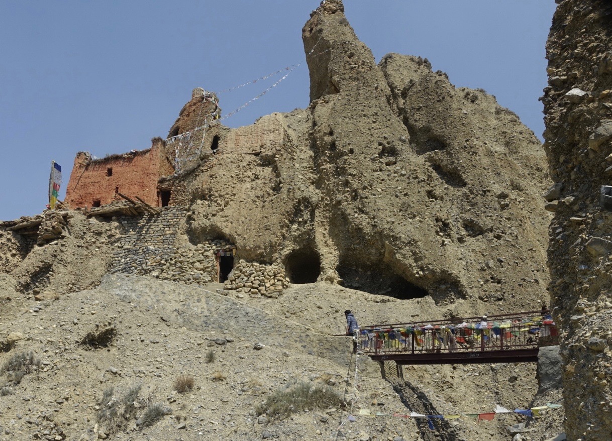
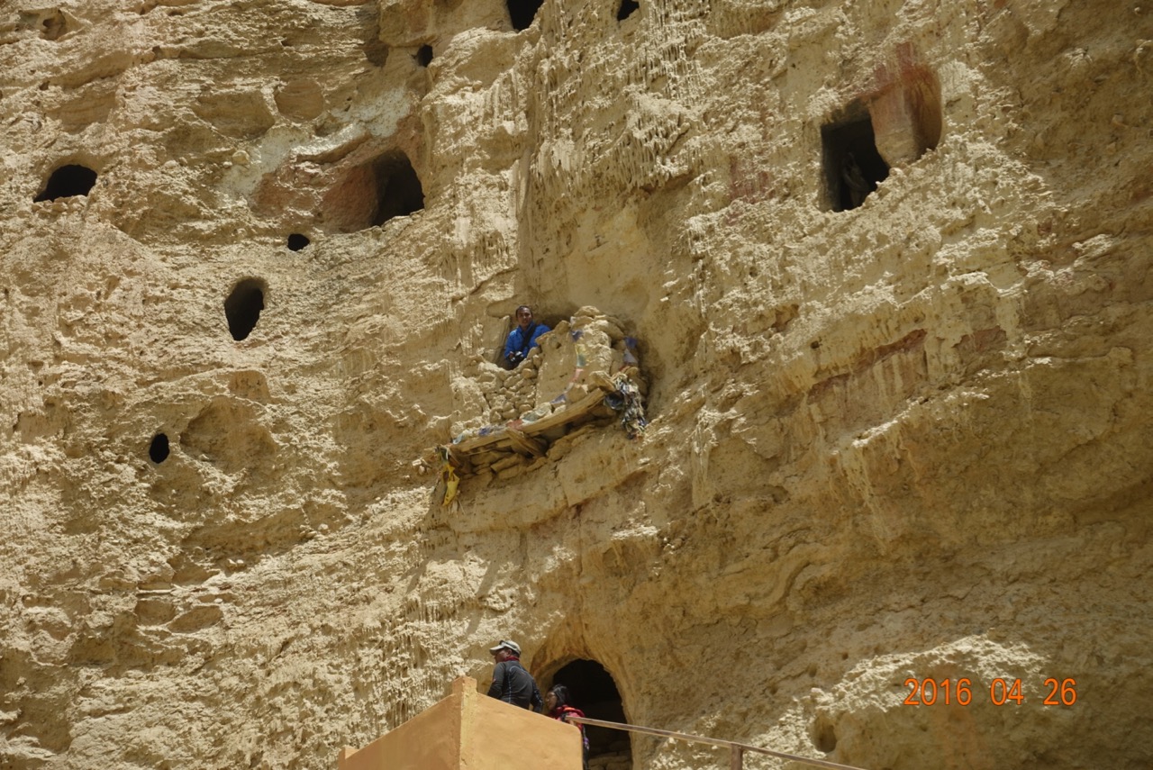
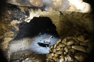
some maintenance to keep things in working order. While moving from room to room, which sometimes involved rickety wooden ladders, I spied on my left a natural window which lit up a cooking pot (looking for all the world to me like a bed pan) sitting on a stool with uneven legs.

Returning to Yara, instead of dropping back down to the river, we stayed up high, on the northern side of the canyon, where a tilting plateau took us into Ghara. new-tea-house-1There, Chaim was surprised to find a new teahouse, built since his last visit. The Honor Man had even improvised a “billboard” advertising the spot! ghara-billboard-1Few tourists had yet visited here, since it opened after the earthquake the year before, and we were among the first arriving this season. Just as in every other teahouse, a picture of Lhasa hung on the wall; instead of the usual hyper-realistic photo, this one was a needlepoint. Next to it, the proprietress proudly displayed her diploma from the ACAP cooking school. I went for a second helping of the Dhal Bat, to her delight.ghara-tea-house-1

Outside, leaving town, we walked by the ruins of a dzong, or fort, which stood guard over a narrow section of the canyon. A few men armed with bow and arrow could have easily old-ghara-1defended the upper canyon, where the monastery clung, from any marauders. Below the crumbling walls, a clutch of miniature horses (the thin air keeps them small) walked in single file, no human in sight. They seemed to be heading back to town on their own, after a day’s grazing in the high “pastures.” Led by a grey mare, a colt came second, his bell tingling brassily as he nodded up the hillock next to us. Then a yearling, and and adolescent – probably this mom’s entire brood?

ghara-horses-1

We came into Yara the back way, right through the town’s fields. Only recently sprouted, the barley was watered by a single irrigation stream from the high country. In the midst of the forest, a young man, half way up a thin trunk, chopped limbs off the tree for firewood. After the slopes had been deforested by rampant cutting, a Japanese NGO had planted fast-growing timber, and taught the Mustangis to cut only the upper branches. Sort of like tending a rose bush, to have flowers year after year.

Posted in Mustang, Travelogues | 1 Comment

It’s All Downhill From Here

steep-descent-1

A week above 3000 meters, four days of hard walking, two days of rest in Lo Manthang, and we felt ready to tackle the return trip to Jomsom. It looked more primitive than the route out – no “road” to follow anywhere, just glorified goat paths, reaching a high point near 14,000’, with a scarcity of villages and tea houses. First stop: Yara, where we would stay two nights, with a day trip up the Pyung Khola gorge to view the Luri (cave) Gompa.

Already I was growing tired of the Gompas. “Don’t show me any more Gompas!” I whined to Chaim. He just gave his round Nepali grin, briefly sticking out his tongue to let me know he got the joke.

First, we had to get to Yara. It seemed simple enough…just follow the Chinese road south out of Lo, back the way we’d come, then turn left out of the Kali Gandaki into the Pyung gorge. But Chaim, who claimed to have been to Mustang “50 times” had other ideas. Before we hit the top of the windy La where Cheryl had placed her prayer flags four days ago, we headed left on one of those goat paths.

We chugged uphill a bit to the day’s high point at 4050 meters (13,300’), then cruised along a plateau for a mile or so, until we came to a small junction. Old stone foundations hugged the saddle between two sharply dropping valleys, prayer flags flying and flapping in all directions from a stake someone had secured to a corner. We had been dropping for a while, down a fairly steep slope, and were looking down an even steeper section. Waiting for us was a growing party of French-speakers, who were headed with their guide and porters up the way we’d just come.

They were aiming for Lo, and I wondered why they were taking this arduous route, so much more difficult then the gently rising road we’d followed into the walled city. My wonder turned to astonishment when a mother and crying toddler appeared over the crest. Several minutes behind them was a young woman who seemed to be taking one step every ten seconds. It didn’t seem possible she would make it to the top.

We’d had trouble enough just coming down the 25-30% slope on loose gravel. We didn’t want to fall, valuing the integrity of our hips, so each step was an exercise in stability, making sure of the purchase before taking the next, using both trekking poles for a minimum three-legged stance at all times. The toddler was continually whining and crying, ignoring her mother’s attempts at appeasement with granola and gatorade.

We skidded down further, reaching the top of a sheer wall of fluted spires. There seemed no way through. Coursing through the spaces between the sandy towers were chutes which resembled the start of a log flume ride. I was in the lead at this point, and had no idea where the trail went. Chaim pointed at one of the gullies, and down I went.

The wind, which was merely blowing at the top, was downright howling as I entered the slot canyon. The flutes funneled the air into the narrow space, accelerating the flow into a gale. I tightened the straps in my solar panel light cap, pulled my Buff up nearly to my eyelids, and braced myself for the dual challenge of the downhill into the wind. It was howling so, I was compelled to take a video of Cheryl and Chaim coming through the chasm.

Out the other side, things really got no better. The trail became steeper. At times, I felt like just giving up and sitting down, sliding to the bottom. The fear of (a) not being able to stop, (b) encountering a cliff, and (c) shredding my pants kept me standing and trying to walk. But it felt more like dry-land skiing than a stroll in the woods. Mostly, it was just rolling through the scree.

Looking down, we could see the oasis town of Surkhang, across the river from Dri. Up on the hillside, terraces abandoned when the irrigation stream dried up, revealed just how tenuous the hold on life is for Mustangis.

a-tree-1
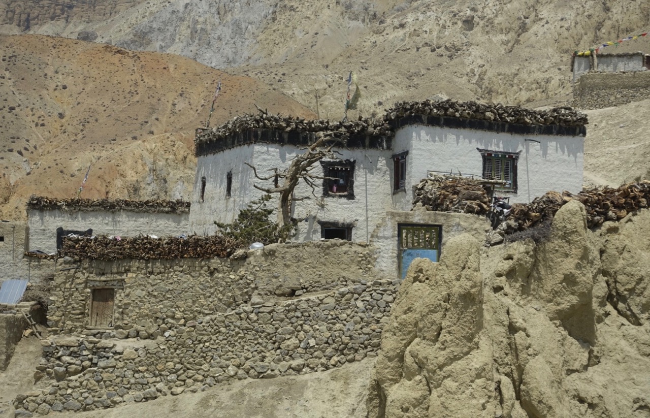
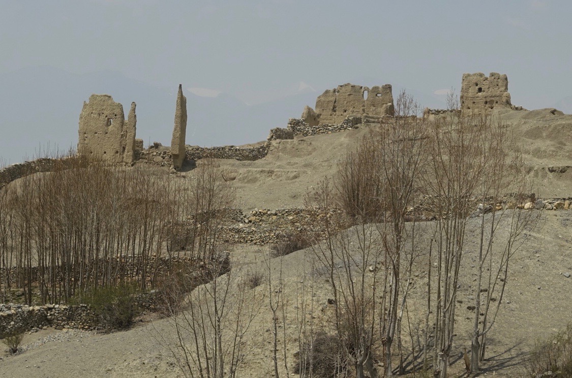
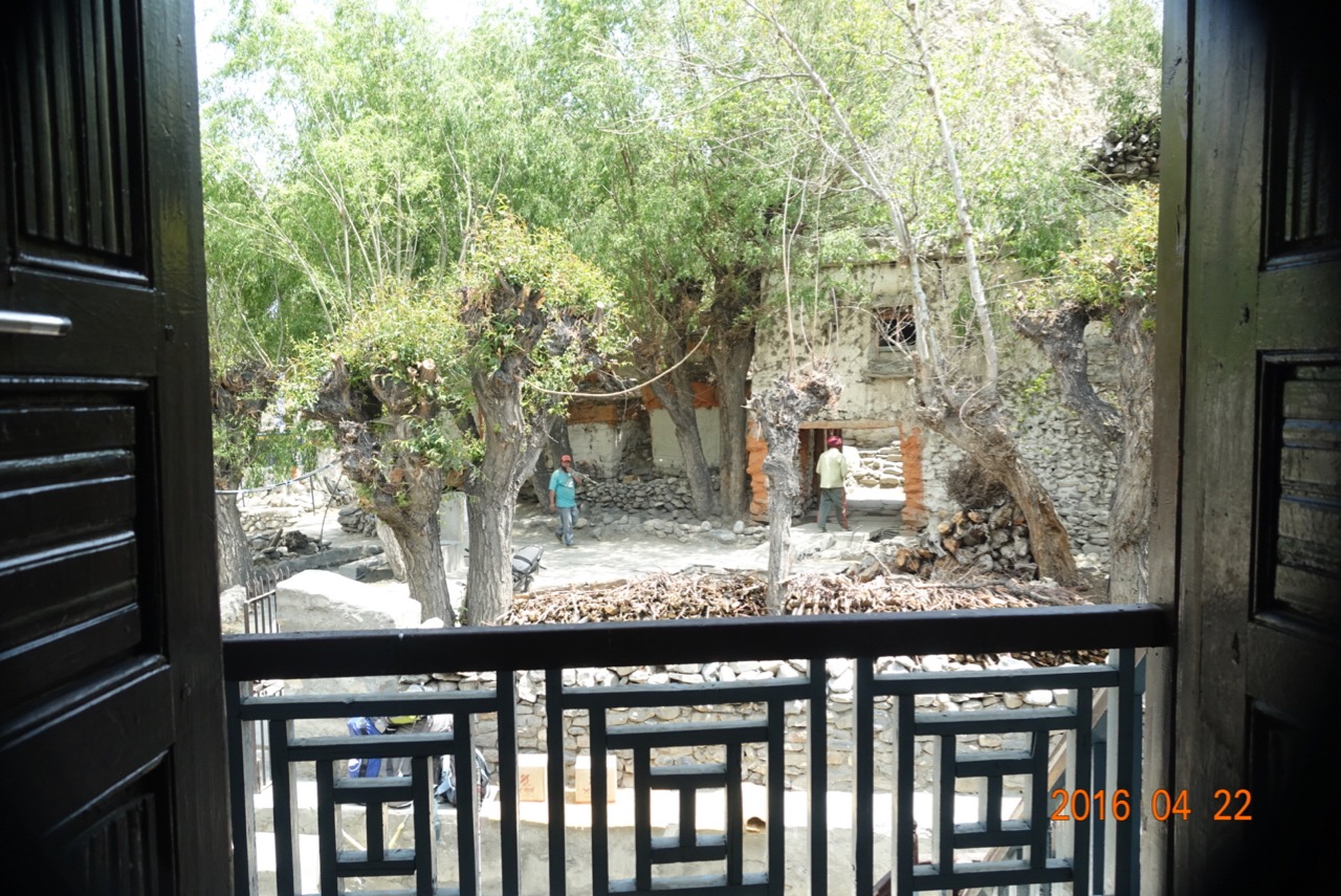
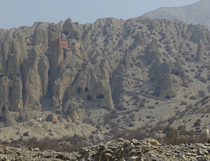
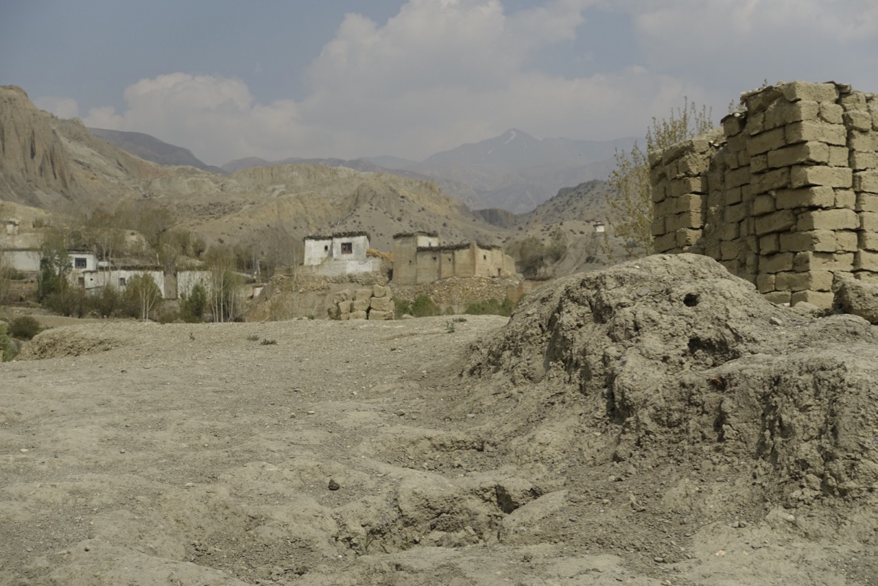
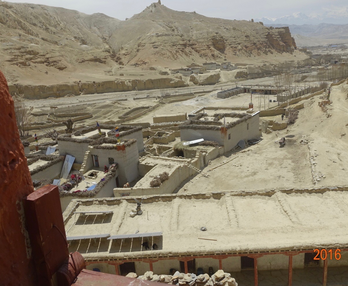
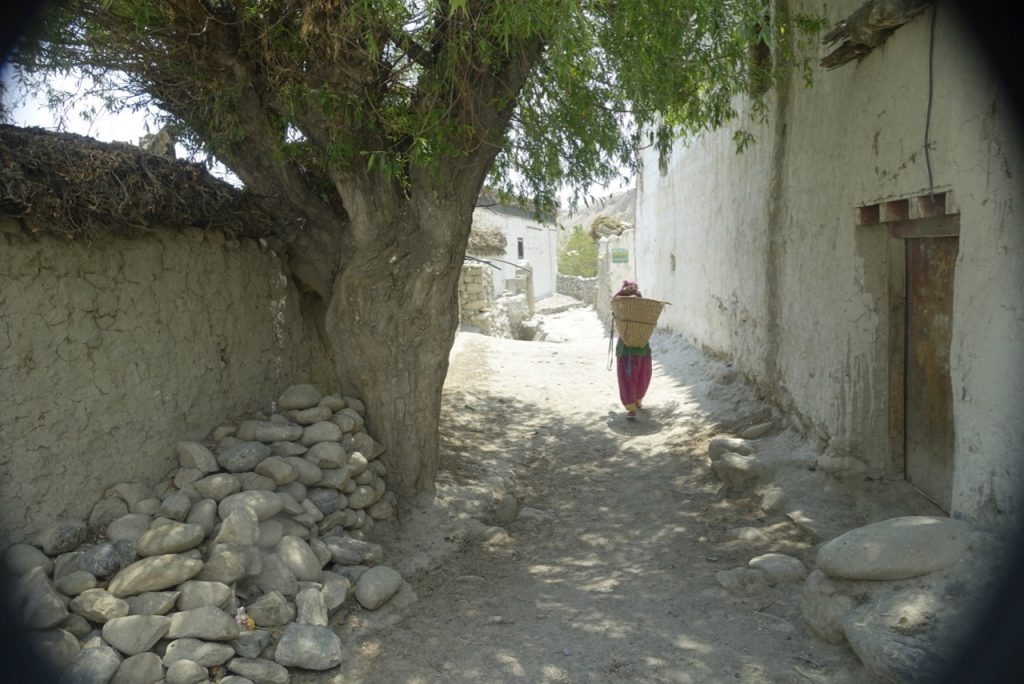
Down in Dhi (pronounced “Ghee”), narrow alleys led us to our lunch stop. Along the way, one massive cottonwood provided shade for a few pigs and a solitary yak dung hauler.

Just out of town, we crossed the Pyung Khola. Heavy treaded rock trucks simply drove right through the torrent, but trekkers used a crude bridge over the swiftly flowing freezing water. Piles of stone on each side supported two long planks, across which unevenly sized cross pieces had been nailed. No two were the same length, and the whole contraption teetered with every step.

steep-descent-into-yara-1

In this photo, you can trace our route down into Dhi. We crossed the saddle from Lo Manthang, in the far upper right. Then we headed down the broad smooth steeply tilted plain, heading down towards the center of the picture. There, we entered the slot canyon, emerging onto the trail aiming back to the right towards the red building on the right side of town. That is a monastery, with a large satellite dish plunked down in front of it. Then through the town, across the river on the rickety bridge, and up the hillside towards Yara. Here, the way became steeper still, necessitating a long set of stone steps to a small La, for the final descent of the day. In the very bottom right is an orange arrow. This marked the route the runners had taken two weeks earlier.

more-steps-1

clouds-and-bricks-1

Entering town, we saw our first real clouds in a week, a harbinger of that night’s light snowfall. Stacks of adobe bricks, a sign the town was growing and needed new homes, lined the way up to our teahouse, home for the next two nights. A polyglot crew of tourists joined us that afternoon – French, German, and some really rowdy Russians. They contracted with the local Honor Man to have town folk come in after dinner for an evening of local singing and dancing, featuring Russian foot-stomping and beer slamming.

Posted in Mustang, Travelogues | Comments Off on It’s All Downhill From Here

Lo Manthang: Sights and Sounds

lo-map-1

Our room looks out over the stone path which runs along Lo Manthang’s eastern wall. With daylight comes the shuffling, clacking sound of older Mustangis, twisting prayer beads, heading towards the mani walls outside the monastery. Their prayers are hummed, a mumbled sound like flies buzzing circles round my head. Wrinkled grandmothers brush dust away from shop entrances, using brooms made from bundles of thin stiff reeds tied together with multicolored fabric taken from the end of a hand woven apron. Young men dressed, unlike their elders, in blue jeans, athletic shoes and western winter Holofil jackets, urge goats and horses out from the city towards that day’s field. Their hooves clatter on the stone, and their breathing melds into a chorus of snorts and wheezes.

Across the Plain of Prayers, the sun angles weakly over distant hills, setting off ground fog rising from the nearly frozen earth. In the yards across the way, I notice piles of rock – free and plentiful – mixed with timbers (much more precious), ready to be assembled into houses where fields now bristle with last year’s crop of barley stalks. More young men, shoulders hunched against the chill, gather themselves into a construction crew. They are joking amongst themselves, I assume, as laughter ripples up.

Today, we’re going to Choser/Garphu. Chaim and the Honor Man have arranged horses, so we can “rest” after five days of walking. I manage a couple of miles stuffed onto the wooden saddle, but find walking a bit easier on my nether parts and knees. As we roll into the morning tea stop at 10 AM, a clutch of pre-teen girls, talking and giggling, walk up behind us. Cheryl smiles and asks, partly in sign language, if she can take their picture. Surprisingly, the tallest answers in English.

“Where are you going?” Cheryl queries.

“School.”

“What are you learning there?”

“We learn English, Tibetan, Nepali. We study maths. We learn about history of our country.”

The school is right next door to the tea house, and even though there is no bell, and none of them has a watch, they know classes are starting, so the photo shoot is cut short while they skip ahead. Apparently, school starts at 10 AM and runs to 4 PM, allowing time for morning and evening chores, as well as the 1/2 hour walk to and from their homes.

cave-complex-1

Back on the horses, we head up a side canyon, towards one of the the local attractions, a cave only recently abandoned. After a climb up newly built concrete stairs, we enter a maze of rooms, carved mostly by the wind, but some further hollowed out by human hands. None are large enough for me to stand in, but Chaim, 10 centimeters shorter, manages just fine. There is a lot of climbing up and down ladders, squatting through rock windows, and wondering how and why anyone would be living here. But there is room for an entire clan in the warren of cool, dry cavelets.

Back outside, the noon sun highlights red rock flutes and hoodoos lining the river bed we follow to the next stop, a cave gompa. Centuries ago, monks began using a hollow space in the cliff for their monastery, and built a fourth wall to protect it from the elements. Inside, the chapel follows the standard gompa pattern. But the paintings are done directly on the rock walls, curves and striations of the sandstone.

monks-quarters-1The Key Man tells us all the monks are today en route from Jomson to Choser via Mahindra jeep, coming back to work on building their new quarters, plant the summer crops, and re-commence religious training. The new quarters are a one-story dormitory, sitting just in front of more traditional two- and three-story homes. Yet even the older buildings have tin roofing lying on top, ready for installation, as well as solar panels and fresh water storage tanks. They are off the grid, but not without power. Soon, we’re assured, a cell tower will appear.

As we head down valley for our three hour ride back, we pass through a sudden splurge of green, grassy shoots fed by a stream tumbling from the mountains sourrounding us on three sides. We are at nearly 4000 meters (13,200’), yet the snow-capped peaks all around rise to a high point of 6235 m (20,450’), with the ridge mostly 1000 meters below (17,000’) On the other side of the ridge line is China/Tibet. The low point, Kora La, represents the easiest crossing from Nepal to Tibet. The rutted gravel double track road recently completed by Chinese engineers tops out at at 15,288’.

For centuries, this route was a foot-and-horse path, the “Salt Road” across which traders brought that essential mineral from the Taklamakan desert in what is now northwest China, down to India, in exchange for spices and seashells. Now, the Chinese are hoping to influence Nepali affairs by re-commencing trade. But the road appears deserted, and the only sign we see of that influence is a profusion of Chinese toilet paper in the local shops. Indian and Nepali goods otherwise predominate.

We follow the Nyichung Khola river valley back to Lo. We cross a side stream on a suspect wooden bridge. Local travelers must feel equally uneasy, as they have suspended a goat’s head beneath the timbers to appease any evil spirits who might have designs on the structure.

bridge-head-1

Posted in Mustang, Travelogues | 1 Comment

Lo Manthang: The Dzi Stone


dzi-stone-1

In 1972, the United Nations Educational, Scientific, and Cultural Organization (UNESCO) began a campaign to “protect the world’s cultural and natural heritage”, through the designation of World Heritage Sites. About 1,000 such sites exist now. In my part of the world, the western US, these include: Olympic, Redwood, Yosemite, Grand Canyon, Yellowstone, and Glacier National Parks; and Mesa Verde, Chaco Canyon, and Taos Pueblo indigenous sites.

The 175 signatories to the Convention establishing this program also list 1750 sites suggested for inclusion. In Nepal, there are 15; one of these is the medieval earthen walled city of Lo Manthang. Reasons for inclusion are the collection of chortens, mani walls, stone and earth dwellings, and the continuing language, culture, and religion of western and central Tibet. A close analogy would be the Taos Pueblo complex, where people have lived continuously for over 1000 years in the multi-storied adobe village.

Tuesday morning, we were set to tour the several monasteries within the walls of Lo. We met our guide by the mani wall in the plaza outside the largest monastery. He introduced himself in hesitant, accented, but perfect English. Like most of the locals, he was dressed for the cool weather in blue jeans, a western plaid shirt, and a puffy fake down jacket. His dark hair was a bit unkempt, and he had a scraggly beard of uncertain age. Just below his welcoming smile, around his neck, he word a small stone threaded lengthwise through some braided nylon string, with a short red tail at the bottom.

“What’s that around your neck?” Cheryl asked. “It looks like a Dzi.”

He nodded. “Yes.” He smiled sheepishly. “I find it outside, in the fields, last year during planting. I don’t know how long it was there. I don’t know if it’s real, but I like it, so I wear it for its power.”

Dzi stones are small decorative agates, usually mixing dark brown and white segments. They feature one or more (up to 9) “eyes”, which are the shape made by the white part of the agate. They have been ground, rounded, and polished, and are almost always cylindrical or ovoid (like an American football) in shape, maybe two centimeters or so in length, less than one in diameter. There is a central hole for the thread.

“Real” Dzi stones are often hundreds of years old, passed down through generations. Venerated for their power unique to the shape and character of the eye, they bestow fortune and promise to the wearer by interacting with his own aura, providing hope in various areas of the human travail: marriage, agriculture, children, spirit – all are enhanced by the proper stone.

Over the centuries, a real Dzi stone will develop distinct but subtle signs of age and wear. The thread hole will become worn at one spot, where the string has rubbed. The agate surface will develop cracks from microscopic particles of water freezing and thawing over time in the harsh climate. Tiny red to dark brown spots of literal rust from the iron within the stone may appear. If all these are present, there are many eyes, and the pattern is especially propitious, Dzi stones can fetch enormous sums – $100,000 or more – from collectors. We had seen a few Dzi in the “Uriah Heep” store the previous day, going for $250. But we knew nothing of how to tell their value.

art-gallery-1
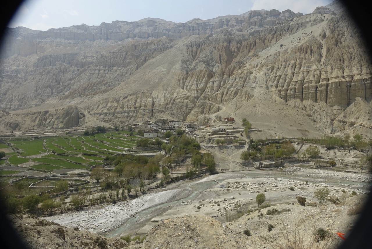
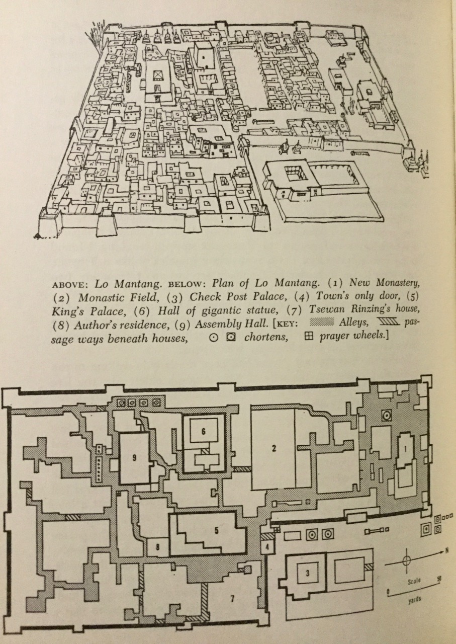
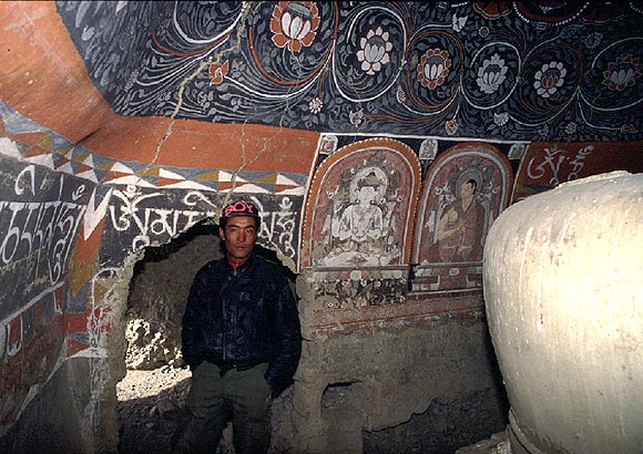
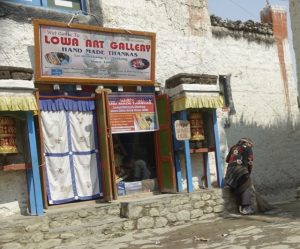
Before we entered the first monastery, our guide gave us a bit of his background. Second-born, he entered this very monastery as a young monk at age 9. By the time he was 19, he was traveling all over Nepal and even to Tibet, visiting other gompas. Finally, at 26, he realised he wanted to be in the world. In Kathmandu, taking a nine month course in mural restoration to help repair the old wall drawings in his home gompa, he met another student, a girl, and fell in love. Knowing that wouldn’t sit well with the lamas back home, he quit the order, started work on cleaning and repainting the walls he had stared at while trying to read the ancient religious texts. He began giving tours of Lo, and eventually opened his own shop where he sold exquisite reproductions of the intricate paintings found on so many Buddhist chapel walls.

Following us into each of the sites were a threesome, about our age. Two ladies and an older man, all Himalayan in appearance. One of the women seemed to be the leader, or at least the most assertive. Eye-catching in her bright red outfit, she was speaking English in a pastiche of accents: Canadian, English (Southeast/London) and Nepali/Indian.

Since we seemed on the same path, we started a small conversation. Cheryl asked what they were doing.

“We are here with my brother, so he can see these places before he goes.”

“Where are you from – I hear Canada, India, and England in your voice,” I ventured.

She smiled. “Yes it is funny, where I’m from. I was born in Tibet, but in 1959, fled with he Dalai Lama to Dharamsala. From there, I went to college in London, then got a doctorate in Asian studies at Oxford. I finally moved to Toronto, where we live now.”

“You are here on a pilgrimage of sorts …?”

“Yes. It is important to see these places, and it is so hard for someone like me to get to them in China now. And why are you here?”

I told her my story of reading Heinrich Harrar, longing to see the Tibet he traveled through in 1942/3, drink rancid yak-butter tea and eat Tsampa, and hear monks chanting and gongs clanging with the single note long-horns.t-c-i-woman-1

“Now that Tibet is gone, I learn. Tibetan Buddhism, and its view of the world and how people should live together, is a treasure for us all. I think it is important for the world that it not just be allowed to disappear. So I am here, I’ve discovered, to honor that, and do my part to keep these people here, in their ways, and then take that story back out into the world.”

“Yes, I can understand that. Our hearts were broken, of course, when we had to leave. And it has only gotten worse since. Mustang is a place where the Tibet that was, still is, and I do hope the modern world coming in, the electric wires and cell phones and internet, do not change the things that are underneath.”

“I’m worried about what could happen when the current Dalai Lama dies. It is scary what the Chinese might do.”

“Yes, we worry about that, too.” She smile wanly, with downturned eyes, no humor there.

cement-lady-1Outside the gompa, in the courtyard where the monks lived, the contrasts persisted. A traditionally dressed local woman sat in front of a churning cement mixer. Instead of wet mud, they were now using modern building materials along with the river stones for the growing dormitories. Around the corner, teen-age monks in red robes were practicing for the dance they would perform at the Tiji festival next week. Some had red Nike sneakers on, others had red sweatshirts with random English words emblazoned. One daring boy wore a red ball cap which had “Oh, Shit” across the top. They all smiled and tried to keep in time with the choreographer.

As we moved towards the gompa housing the giant Buddha, I asked the Canadian/Tibetan pilgrim about our guide’s Dzi stone, which he had given us to appraise. She looked at it very carefully, turning it over multiple times.

“I am not an expert. I can’t tell you if this is a true Dzi stone or not. It does have some characteristics of an original, but others are not in keeping. But what is more important is how it makes you feel. If you feel a connection with it, that is what is more important than the age or depth of its water marks. Especially if there is a story you have with this one, like the guide has told you.”

I thought of our conversation, about the need to keep Lo Manthang vivid as a living place where the Tibetan ways and thought were active and evolving, out of reach of the Chinese thumb. If giving $200 could help a man struggling to make a family and a life here, restoring the monastery, that was one way I could support the real purpose of my Tibetan pilgrimage.

Posted in Mustang, Travelogues | Comments Off on Lo Manthang: The Dzi Stone

MiamiMan, 2016

swim-1

Two years ago, the ITU announced that its 2017 long course (4k swim/120 km bike/30 km run) world championships would be in Penticton, BC,  just over the border from Washington. Not only close, but a a race distance which seems on the sane side of effort, while still an endurance challenge – 9 hours or so at my speeds. To get there, I needed to qualify for the USATriathlon national team at its 2016 long course (half iron, in this case) national championships in Miami, Nov 13, 2016.

So thats why I’m flying back and forth across the country, 6+ hours each way non-stop from one corner to another, over a four day weekend. Then racing on a perfectly flat bike course in South Florida farmland and running 13.1 miles through the Miami Zoo, past alligators and giraffes in 84F heat. In the six months before, I’d covered 3640 miles on 100 bike rides, swam 150,000 meters, and run 120 times for 620 miles, so I was certainly ready to race.

I figured I could do 37:30 in the small inland freshwater lake (76F, wetsuit legal), and that’s exactly when I came out of the water. On the bike, I was gunning for a 20.6 mph average speed,; again, my precise outcome. I’d been planning on 56 miles, of course, or 2:45. But the ride was 2 miles short, so I ended up just a shade under 2:38. Transitions, I;d had no idea how big the field would be – nearly 2000 participants in the half iron, long course duathlon, USAT NC Aquabike, and Olympic distance race made for a long transition area – but I’d planned on 7 minutes, and got 5:40.

So by the time I hit the run, I was feeling pretty good.  I was 5th (out of 20) after the swim.  I passed one guy on the bike. In the first two miles of the run, I passed another who was struggling (he’d end up walking a 3:08). The heat, as usual, was slowing me down a lot. The best I could muster were 10 minute miles with my heart rate at about 138 bpm (my max is near 160), and I felt, if I didn’t want to blow up, I’d have to keep it there. A lot of water on my head, ice down my shorts, and switching between water and Heed every mile, and I kept a pretty steady pace. In the last mile, another guy in my AG roars past me. I tried keeping pace, but saw my HR quickly rise past 147 towards 151. I may have been able to sustain it for the last mile, but visions of Jonathan Brownlee in Rio at the Olympics this summer, when he collapsed a couple hundred meters from the finish, and had to be carried across the line by his brother. As I said, I didn’t want to blow up, so I backed off to my personal redline for that day, on that course.

Turns out the winner went 5:05, and 2/3/4 were bunched around 5:31, +/- 50 seconds. The speedy guy ended up 2nd, I was gaining on 3rd, but ended up 30 seconds short. I had the 3rd best run on the day. But I felt great about my result: I had conquered the heat by running through most aid stations, not blowing up or slowing down, and nearly hit my top end goal of 5:30 in temps which slowed me by 12 minutes on the run over my speed when its in the 60s. Afterwards, I spoke with the guy who ran by me. He’s from Wisconsin, so certainly not coming from warm training weather. He’d done IM FL the week before. And his open half marathon time this year was actually a minute slower than mine. So hats off to him for his sub 2 hour performance on that run. It always cheers me to see someone who executes to that level, and I told him he had a lot to be proud of.

What I didn’t say, was, I intend to not let that happen again, in Penticton next August.

run-1

Posted in Races, Triathlon Central | Comments Off on MiamiMan, 2016

High Hamstring Tendonopathy

On the EN forum, the issue of high hamstring tendon injury was raised. I’ve had this on both sides over the past year, so I contributed:

I’m going to share my own experience with this over the past 14 months, not to tell anyone what to do, but to document what worked for me, and maybe provide some ideas.

Last year, starting back into training for Kona after Lake Placid, after my first set of TP run intervals, I developed pain on the right side, lower part of my butt, worst when I pressed in under the glute max muscle near the greater trochanter of the femur. Besides the pain, the other key symptom to me was pain when I would “paw” at the ground with the ball of my foot – that became important, as I used that sign (the disappearance of it) to help guide me back to running again. Since I wasn’t going to skip Kona unless I literally fell apart, I looked for ways to train through it. On the training side, I stopped doing speed/interval/high intensity work, and long runs, for a month. All of my running began to be at a faster cadence than previous, with shorter stride length. During August, I was running 5 days a week, 4-6 miles mostly, with a 9 mile and 10 mile run, all @ TRP. In September, I tried two attempt at “TP Intervals”, but ended up managing more like a half marathon pace for 2 x 1 mile. I dropped to 3 x/ week, with two runs of two hours. While my pain never went away – it hurt every step I ran – it also was not getting worse, so I trudged on.

The exercise program I developed during this time was focused on improving lower core strength and flexibility, with an eye towards long-term prevention as well as short term recovery. I played with several different exercise programs, but this is where I ended up, based on what I felt comfortable doings and what I felt was working. Stretching included the Yoga “good morning” pose, standard hamstring stretches, and holding my knee up to my chest while standing. Core work included crunches with my knees up, arms crossed on chest; front plank x 90 seconds; pelvic bridge static x 90 seconds; and pelvic thrusts (slow, emphasizing gluteal contraction) x 30. I did 30 side leg lifts, 30 clam shells, and 30 “reverse clams” (lying on the side, lower leg with knee bent, upper knee stationary close to lower knee, and rotating the upper leg so the foot went up and down). All of these were focused on feeling effort and strength in the hip flexors and small and large muscles of the gluteal area. In addition, I did side leg thrusts, front leg thrusts, and single leg knee bends, aimed at patellar stability. I tried to do these every day, usually managed 5 per week. One thing I should note is that for some stupid reason I had stopped doing most weight room and core work for about a year. Since I’d never really gotten any significant training injuries, I thought I must be immune, and stopped following my own advice to OFs to not give up on weight work, ever. So I decided maybe a part of the recovery should be a return to better strength, emphasis on helping the poor hamstring do its work.

While I was able to finish Kona, I only ran about 13 miles total, due to the pain. Since I had hernia surgery scheduled three weeks later, I shut down my running from that point forward, continuing with weight lifting (leg presses, seated quad lifts, no hamstring work) and the above stretching and core work. I had the surgery, & thus enforced rest from running. I started back up running after two months after Kona. In Dec, I ran 15 times/45 mi; Jan, 15 x/65 miles; Feb 11x/55 miles, working up to max 7 miles. Then, Feb 27, I broke my R great toe, and stopped running until May 10th, By the time I started back up, I was totally pain free, but very slow.

I did a standard IM build up from May 10-Oct 1 of 20 weeks, and while I got no faster (like 30 seconds per mile slower than before the injury), I remained pain free, which was my major goal. i did IM MD (at a very slow, but persistent 10-11 min/mile), 10 days later, I tried an interval treadmill set which went OK, and two days later tried an 80 minute treadmill progressive run. (It literally rained non-stop for seven days, which is why I was on the treadmill.) That was Sunday; on Monday, my left hamstring hurt worse than the right ever did the year before – the injury before Kona had been on the right. That scared me almost out of my mind, since I had my A race for the year coming up on Nov 13th. Like Kona, I was going to do that event unless I was in the hospital or a cast. So I took two days totally off from running, but kept up with my stretching and core work. then gingerly tried to go back to running. It hurt, but I persisted. Within a week, I was able to do some interval work, and managed three “long” (for HIM training) runs at reasonable pace. By race day, pain was not on the radar screen.

I had a respectable run in terms of HR, but my pace was a minute/mile slower than I anticipated. Probably a combination of the temps being 85F (this was Miami), and my training being inadequate. Two days after the race, I remain pain free.

So my personal conclusions:

  • Risk factors include: aging elite athlete; rapid return to intense training after an IM marathon; abandonment of weight training. If you’re over 50-55, stay in the weight room, and be very careful with building back into intense running soon after a marathon (either stand alone or IM)
  • In addition to the benefits of regular weight training & flexibility (stretching), specific exercises for the lower core (mid-thigh up to top of pelvic bone) are helpful for both prevention and return to pain-free function.
  • A period of rest can be helpful, but returning to running within a week is also feasible if the pain is improving while running. If it stays the same or gets worse, shut it down for several months in the off season.
  • Hamstring injuries are scary. I’m going to be doing my exercise program for the rest of my walking life.
Posted in Uncategorized | Comments Off on High Hamstring Tendonopathy