Lo Manthang: The Honor Man

mom-c-baby-1-1

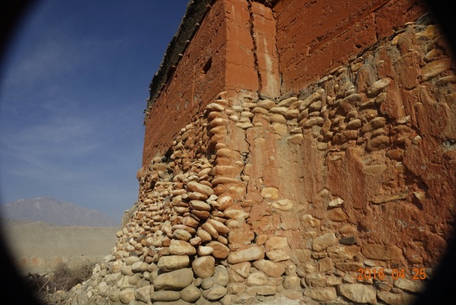
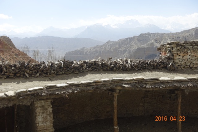
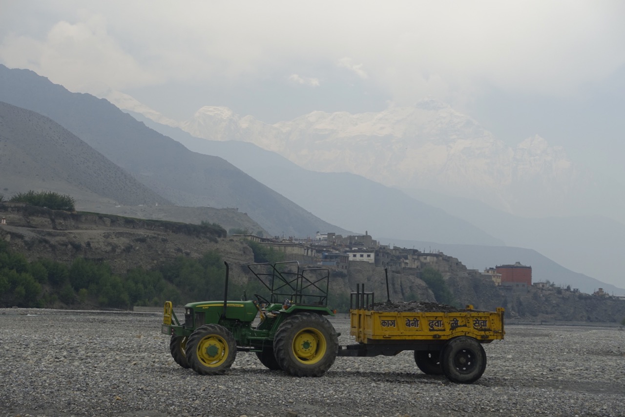
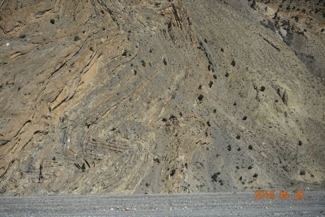
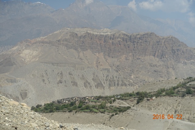
In late April, the trees surrounding Lo Manthang were still leafless. Tourists were not expected for another week, for the Tiji festival. Chaim led us into the check point, just outside the sturdy, whitewashed stone and stucco city wall. While he had our papers reviewed and stamped, and caught up on local news, I perused the bulletin board, titled “Annapurna Conservation Area Project [ACAP]”.

ACAP, a development program of the Nepalese government, is responsible for improving the lives of those who live in Mustang and the adjacent valleys. Roads, schools, local health clinics, adult training programs, building projects – the impact is everywhere. These people, who as recently as fifty years ago lived in almost complete isolation from the rest of the world, now have solar panels on their roofs, children who are learning Nepalese, Tibetan, and English, central clean water stations, and sporadic indoor plumbing. While the old lifestyle of herding and farming, in primitive stone villages, may seem romantic to us, I’m sure the newer ways are welcomed.

honor-man-1Among the program descriptions on the bulletin board was a table listing all the foreign visitors to Upper Mustang since it opened to travel in 1992. Month-by-month, and country by country, I could trace the growth of tourism. Before the turn of the century, visitors annually numbered in the hundreds, almost all between May and October. Leading up to 2015, the numbers rose to 3500, then 4500, with winter becoming an attraction. Then, the earthquake. Visits plummeted to 1500 after that April day, 2015. No wonder the people at the tea houses were so glad to see us – it seemed every village had a new one, and they proudly displayed their recent graduation certificate from “Basic Cooking” school.

France, Switzerland, Australia, New Zealand, and the USA, in order, have the greatest number of travelers. I estimated that no more than 3500-5000 Americans had been to Mustang – a bit less than 10% of the total. I felt a rare privilege in gaining access, lucky to have both the time and money to visit, to make the pilgrimage.

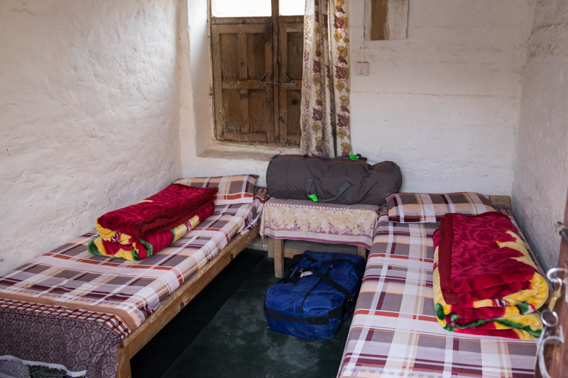
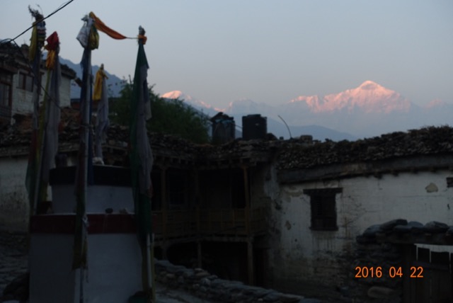
Our tea house seemed almost palatial. Entrances led off in three directions around a small inner courtyard. On one side was the dining area, on the other, lodging. Porters occupied the small rooms on the ground floor, which also housed a common shower. Up narrow, off-kilter wooden stairs, through a low-bridge beam, were a ring of private suites opening onto an overhanging balcony. Suites, as we had not only a room with two cot-like beds, but also an attached toilet and sink. The third side housed the kitchen and living quarters.

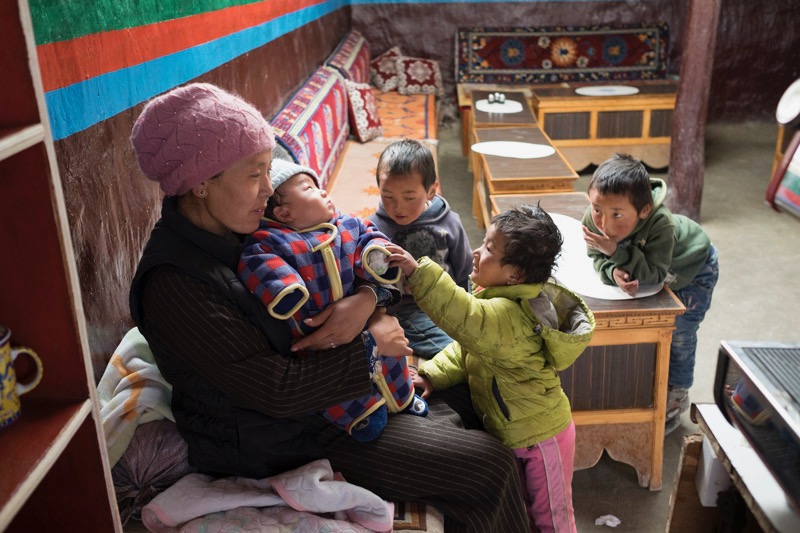
After changing out of hiking boots, always the first event when coming off the trail, Cheryl and I went down to the dining area. A middle aged French couple with their guide were going over a map for their next day’s journey. A Tibetan woman approached our table, and asked us about tea. She seemed to speak some English. Cheryl noted an infant sleeping soundly on one of the benches.

“Is that yours?” she asked.

“Yes, my baby.”

“How old?”

“Four months.”

After our tea came, the baby start crying a bit. The mother picked her up, rocked in a blanket, and calmed her down. “Where are you from?” she asked.

“America. Seattle.”

“Why you come here?”

“It was our dream for a long time. We wanted to see the people here, and eat their food,  the tsampa, drink their butter tea.”

Haltingly, but with great feeling, she said, “My dream is to go to Kailas…”

“To make the circle around the mountain?” I ventured.

“Yes, that is my dream. I hope to do that.” Mt. Kailas is the holy mountain for Tibetan Buddhists. I don’t know the cosmology involved, but it is spoken about with the reverence Muslims use for Mecca.

Chaim came in, his usual smile and chuckle lighting our space. “How you like your room? All moved in.”

We assured him all was fine. Then he said, “Tomorrow, we go to Chosar. See cave Gompa.”

“How much of a walk, how far is it. We’ve been hoping for a rest.”

“Oh, not far – 2, maybe 3 hours.”

“There and back?.”

“Three hours to get there, maybe 2. Then we see the monks, then we come back, OK? I can see about horses for you. I will ask honor man if he can rent us horses.”

“That’s good, we’d like that…but, who, uh, what is the ‘honor man’?”

“Honor man .. he is the man who on this place, the husband of this lady” – he pointed to the mother rocking her baby – “he can get us horses.”

I pondered this description…”on” this place? “honor” man? and a light bulb went off – the OWNer man! Honor man – I liked that appellation more.

“Chaim, can we go into the town? We want to walk around a bit. Maybe see the wall.”

“Yeah, sure, you go for walk.” He laughed. “Wall is right next to you.” He pointed toward the kitchen. “People starting to build houses against wall.”

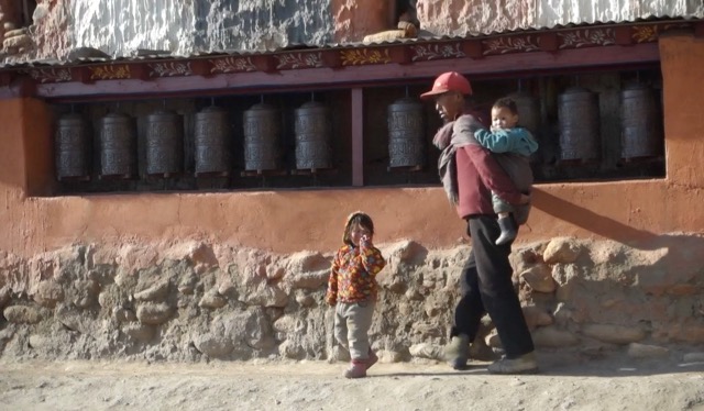
We walked outside, and faced the entrance. A narrow alley between buildings ended at a white stone blank, maybe 5 meters high, with red paint along the top.

“That is wall. It is back of honor man’s tea house.”

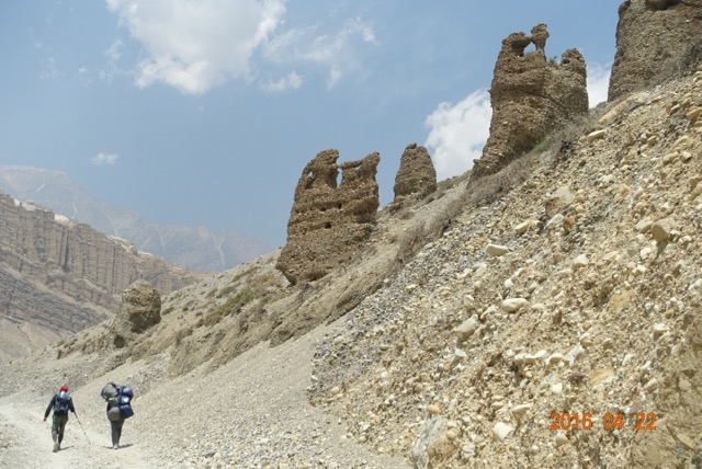
“So how do we get into Lo? Where is the entrance?” We knew from our research, Lo has only one public opening through the wall – a holdover from 700 years ago, when Ame Pal constructed the place as a fortress city.

It took us less than five minutes to get there, and once in, the buildings crowded in everywhere. Clearly not designed even for cart, much less car traffic, many of the alleys were only wide enough for two goats to travel side-by-side. But turn a corner, and a broad plaza would open up. Then, the way closed in again. Meandering blindly, it took us less than ten minutes to get from one end of the city to the other. In a couple of the plazas, small shops with hand-painted wooden signs announced in English and Nepalese what wares could be had inside.

lo-plaza-1

Cheryl wanted to do a little shopping. The stores in Lo proper all seemed to be closed, but on the way back home, we found a small store which reminded me of Uriah Heep’s, a now defunct emporium in Aspen. There, the owner made his living traveling the world and picking up locally made artifacts for the delectation of those from all over the world who came to Aspen. It had always seemed a bit round-about to me, and, maybe deservedly so, it only lasted for a few years.

But I did buy some of my most prized possessions there. First, a three-legged milking stool, representing the “consumer-owners, doctors, and management” who made up the leadership of the cooperative where I worked for 35 years. Next, a hand-held Tibetan prayer wheel, which spun smoothly whenever I felt a need to connect with the earth and its sentient beings. It was fun to wander through Uriah’s and dream about visiting the lands from which its wares had come.

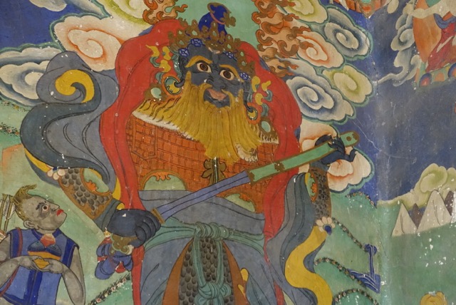
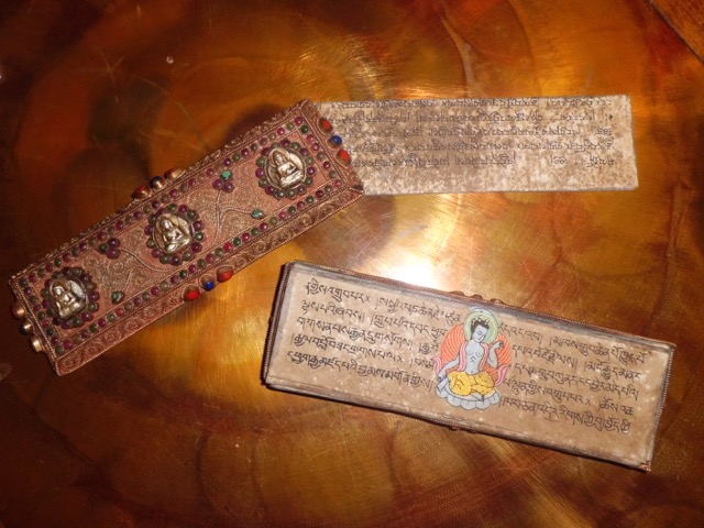
And now here we were. I asked the owner about many of the objects, and where they came from. He said during the winter time – the off-season, I presumed – he traveled via the new road into Tibet, and visited the remaining monasteries, and smaller towns, looking for objects people might want to sell. He had mani wheels meant to be nailed beside a door. He had Tibetan medicine books – those books with no spine, and grandly decorated covers, with hand written illustrated loose leafs inside. He had hand woven rugs and thick wool aprons, and paintings modeled after monastery walls. He had Dzi stones and drinking mugs.

Cheryl wanted an apron, and I wanted a book, and maybe a mani wheel. But we were worried about getting them back home. While the proprietor promised that shipping would work out just fine, we were leery, having seen the sporadic nature of motorized travel in these parts. It just didn’t seem safe to spend hundreds of dollars on the hope that DHL would eventually deliver the package to our door. The only other option was to have Pasang, our porter, who was already carrying not only his own pack, but each of our 15 kg (33 pounds) loads, to add these surprisingly heavy items to his burden. We promised to come back in the next day or two after discussing that option with Chaim.

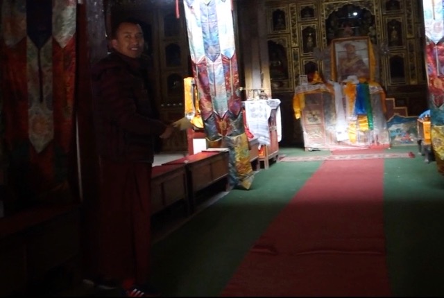
That evening, instead of eating in the formal dining room, we all sat around the honor man’s stove. Porters fed small sticks into the cast iron fireplace, and we warmed up nicely, though I still needed my down coat and Marshawn Lynch-approved Seattle Seahawks watch  cap.

I wondered if the social structure Michel Peissel had described still held sway. The honor man seemed not only self-confident, but also eager to talk, so I started peppering him with questions.

“I’ve heard that the land in families here is never divided, that the first born son gets all, and the second must go to monastery.”?

“Yes, it always get handed down. I was not first, I was third. So my brother has all the field and goat. My other brother went to monastery when we was eight.”

“Is he a monk now?”

“No. After ten year, he left, and went to Pokhara. I had nothing, so I start my own work. When Nepali government open up Mustang, I start working in tea house, and after some year, started it for me.”

He had done very well for himself. Not only did he own one of the biggest “hotels” in Lo Manthang, he also had jumped at the opportunity when ACAP decided to put medical clinics in each town. He went to Kathmandu for 18 months – while his wife ran the tea house – and learned basic medicine, becoming what we might call a medic or PA. He set up shop just outside the city walls, worked to train other towns-women to help, and now runs the health center, his tea house/restaurant, and acts as a broker for tourist activities.

honor-man-2
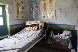
One day just before lunch, at Cheryl’s urging, he took us to the clinic, just to look around and learn about how it operated. Cheryl was particularly interested in pre-natal care and deliveries. We learned that babies were not born in Lo. Once women felt movement, they began to plan their move to Kathmandu for the duration, delivering there in hospital.

Just as he finished this explanation, an anxious woman hesitantly stuck her face into the room. The honor man looked up questioningly as she was followed by a young girl, about six or seven, who was clearly trying to hold back tears while she clutched one hand in the other. Blood dripped onto the dirt floor.

The grandmother’s story poured out, and he translated as he speedily went into the store room for gauze, saline, basin, and some instruments. Knowing we were a doctor and nurse, he let us watch as he explained, “She was crawling around outside her house, looking for something to play with. She found a torn piece of roof” – a jagged metal strip – “and tried to pull it loose. She cut her hand.”

We saw a two-inch long gash running the length of one of her fingers. He was busy cleaning it and putting in several stitches, tying gauze tightly around the digit.

Through it all, the young girl did not cry or complain, just sniffled a bit and looked stoically at her grandmother for reassurance. When Cheryl noted how strong she was, the honor man said, “She mostly ashamed she is causing problem for her family.”

Posted in Mustang, Travelogues | Comments Off on Lo Manthang: The Honor Man

This Magic Moment (Mustang VIII)

lo-view-1

Cheryl was having trouble getting one end of the prayer flags attached to the pole centered in the rock pile atop Lo La. The wind was as strong and persistent as we had yet seen. Chaim, no taller than Cheryl, nonetheless had the stability of one who’s summited Everest several times. While Pasang secured the far end to a large rock, Chaim looped the whipping flag rope over the top of the metal pole rising out of the concrete geo marker which formed the nexus of the pilgrim’s rock pile.

Lo La seemed the end of the world. We had been walking for four hours, and seen not one person or vehicle along the jeep track between Tsarang and Lo Manthang. Half way along the route, a giant lonely chorten stood athwart the road. Surrounded by a short chain link fence to protect against unlikely vandals, it seemed a sentinel marking the half way point between Mustang’s two largest settlements. We stopped for tea, which in this case meant sipping from the gatorade bottle and downing a few handfuls of my nut/chocolate/raisin mix.

Leaving Tsarang mid-morning, we had passed a similar, smaller chorten on the way out of town, standing guard over the town’s rock brigade, gathering that day’s quota of building stones from the river bed. rock-trucks-1-1Then, nothing until the giant stupa. After the tea break, we kept walking through a landscape progressively more arid and devoid of life. As we crested a small defile, hoping we had reached the top, we entered a high rolling valley. To our right, the white sandy cliffside was pocked with caves scoured by the wind. In front, a small patch of green, seemingly filled with bushes which swayed a bit.

Drawing closer, the bushes materialized into … goats. Gnawing away at the patch of green, it was hard to see how they had gotten here, or even how they could survive, given that the grass they ate was only millimeters high, scraggly at best, and limited to a small football sized splotch which seemed merely moist, certainly not a true stream.


goats-1Yet here they were, and in the midst of some ruined buildings, probably shepherds’ huts from sometime past. But they were a promise of the community ahead, harbingers of Lo Manthang.

Just one year ago, an earthquake had trembled through Nepal, with loss of life for some, and homes for others. Locally, there was little nostalgia for the event, but Cheryl was determined to hang a string of prayer flags at the highest point we reached that day, as her way of feeling communion with the people and their land.

I had a different set of feelings. I didn’t realise until I lifted my eyes from the flags, down into the vista spread below and beyond, that I had been seeking this moment for decades. I’d longed for a romanticized version of the Lost Horizon, a land and people cut off from the rest of us, where daily life was the only worry, lamas preached peace and respect for all sentient beings, and mountains ringed a verdant plateau, the Plain of Prayers. Over the past year, my dreams had crystallized around Lo Manthang, the walled city I could see below. I was on a pilgrimage, and my journey neared its end.

I found Cheryl at the top. I squeezed her close, pulled her to my side, and showed her Lo. “We’re here,” I said. “We made it.”

“Yes, we did.”

Posted in Mustang, Travelogues | 1 Comment

Maximum Aerobic Function Training

An EN member posted about “Maximum Aerobic Function Training”: …What is MAF Training:  For me, it was doing ALL TRAINING at aerobic threshold – swim, bike and run, with no high intensity strength training to send my body any other signals.  To find my MAF, I used the “180 minus my age” formula, which was 135bpm, then added 5 points as I have been consistently fit for at least 6 months. The good thing is that when running and biking (and swimming very easy) at MAF, my body needed almost no recovery, leading to healing and consistency (at my age, this is probably the key and what led to my gains)…

My reply to the forum:

1. Whenever this comes up, I reflect on what I heard Mark Allen say at an IM medical conference I attended once during Kona Week. He spoke of his frustration at not being able to perform well, or even finish, @ Kona for years, and then adopting the advice of Maffetone. He explained it in what could be described as periodization terms. He noted his initial skepticism, but was willing to try anything. Here’s what he said he did… for about three months, he did all his running at the aerobic heart rate, and noticed his per mile times progressively dropping. After about 3 months, they plateaued, and, on his own, he switched to a more intensive training effort. Again, that seemed to reach a plateau after 2-3 months, so he switched back to aerobic. He felt this switching back and forth gave him both the strength and endurance he needed to eventually get over the hump in 1989 vs Dave Scott.

Doing one thing all the time will eventually lead to stasis, and we’ll need to switch up our routine to start making more improvements. Same thing applies, to say, weight lifting routines. I switch mine every 3 months or so, as much out of boredom as wisdom, but it seems to at least keep me in the game (which is all I expect at this age).

2. I read the “180-age + 5” concept mentioned here, and discovered that I had indeed been doing this over the years as my “go-to” pace. This year, when I got back to running after a broken toe, I started slogging along at 118, which felt like a sweet spot to me. Turns out that’s 180-67+5! By August, I was ready to start throwing in a bit of intervals, and did a few shorter races. After IM MD, I started back into doing most of my runs @ 120-130, thinking that was the right range for the half iron I have coming up. And my times per mile over the past 6 weeks have indeed dropped, to where I’m down to 8:30/mile, from the 9-9:15 I was at earlier in the year.

3. I think this is a reason why the OS is so effective. Most of us have been doing lot of aerobic work naturally at the end of our season, aiming towards an A race IM or HIM. Then a bit of a break, and its time to throw in some hard stuff, Three months of that, and swing the pendulum back to “far” more than “fast”. IMO, this sort of an approach should not be an “either/or”, but more “a lot(MAF)/a little(intense intervals)” then switch to “a little/a lot”, which the proviso that “a lot” of intense intervals is a relative term, say going from 3% to 10-20% of time/distance.

4. The longer it’s been since one has done real athletic training (meaning: incorporating speed & intensity plus substantial endurance volume) – ranging from never to years to months to weeks – then the longer it will be both necessary (to avoid injury) and helpful (to build up the size and function of the heart) to stay in the MAF zone almost full time. Someone like Allen in the example above who had been training for years as a serious world beating triathlete only needs 2-3 months of MAF before being ready to switch to the other side of the pendulum swing. So this is not a one size fits all plan; it must be tailored to where you are in your athletic career.


Posted in Triathlon Central | Comments Off on Maximum Aerobic Function Training

A Tree Is A Tree…

mural-1

In 1966, while running for the California governorship, Ronald Reagan allegedly said, when discussing the proposed national park to preserve the tall trees of Del Norte and Humboldt counties, “You’ve seen one redwood, you’ve seen them all.” What he actually said was a little more prosaic: “I mean, if you’ve looked at a hundred thousand acres or so of trees — you know, a tree is a tree, how many more do you need to look at?”

That’s how I came to feel about the Buddhist monasteries of Mustang – or the Catholic cathedrals of Europe and South America, for that matter. Yes, they all have their own unique history, their individual creation stories, their intertwinings into local lore. But in the end, they do all seem to look alike, with similar floor plans, decorations, and purpose.

But it took me a few tours of the gompas to figure this out. My first lesson involved the monks themselves. Most of them are boys and young men, aged 9-26. Prior to the late 20th century, schools as we know them in the west were non-existent on the Tibetan plateau and contiguous regions. Second-born males in many families were shipped off to the monasteries, where most of them were temporary residents, gaining an education and safety from the usual travails of male adolescence. Only a small number choose (and it is entirely voluntary) to become full-time adult monks.

All these guys need a place to live, and their quarters make up the outer perimeters of a monastery. Simple rooms with a small wooden cot, maybe a table for a book and a lamp, and a door to keep out the cold wind. Their classrooms and dining hall are nearby, all within the perimeters of a protective wall. Sometimes, agricultural plots for staples are within the compound, or nearby along the outer edges. Throughout the day, boys and young men, heads nearly shaved, roam smiling and red-robed over the grounds, heading between religious rites and daily chores. In many ways, it might be a boarding school but without the athletic fields.

Within each monastery is the chapel building, standing separate in the compound. Squat, square, nearly windowless, it is painted deep red with little external decoration. Outside the single door is often a series of prayer wheels. Steps lead up to a vestibule, where there may be a single large, possibly man-sized or bigger prayer wheel, and paintings foreshadowing the murals which cover the walls of the inner sanctuary. Depending on the age and upkeep of the gompa, these murals may be blazing bright with wildly colored pigments, or covered with the grime from centuries of tallow candles. Vaguely human creatures with scary demon faces, heads lit by dancing yellow flame, dominate the scene. Battles between the forces of light and darkness juxtapose with pastoral scenes from the life of the Buddha.

A few steps lead up to wooden doors, locked, guarding the inner sanctum of the chapel. Invariably, visitors must wait for the Key Man – usually a smiling teen-aged monk, proud to show off the local treasures.

smiling-monk-1

The only light falls from above, a central opening (nowadays covered with translucent plastic) over a set of wooden benches. The room looks practical, not ornamental, with books strewn across the seats, maybe a paint bucket on the floor for trash, and prayer scarves draped over random Buddha statues. The far wall is a glassed-in showcase for the local statuary – gold (or, more likely, bronze) Buddhas of many shapes and sizes – and other treasures. Often, a smiling portrait of the Dalai Lama beams out his message of peace and happiness. Books rest in cupboards below, and to the left.

A word about these “books”. They consist of loose sheets, filled with handwriting, and kept together by a combination of a top and bottom stiff covers, often secured with twine or sash. The covers may be plain wood, or inlaid with metal scroll work and semi-precious stone. Monks will sit for hours, reading aloud or memorizing passages from religious texts. At other times, the books are consulted for medical diagnosis and treatment, or help with agriculture.

medical-book-1

The older monks, the ones who’ve stayed into adulthood, adopt vows of poverty and in most cases celibacy. They live in the world, visiting with family, or traveling to other monasteries near and far. They are viewed as a combination of religious sage, medical shaman, and moral talisman. But they always have quarters in their home gompa, even during the winter when most will travel to lower, warmer climes.

The monastery grounds are always open. A common sight is an elder walking by the mani wall, spinning the wheels on the way to or from the day’s errands – an convenient way to pray and be blessed.

man-at-mani-1

In Tsrarang, the local lore revolved around the architect of the winter palace and the central monastery. He was so revered that, after he died, his right hand was preserved, and now hangs within a musty relic room, next to swords and shields from some forgotten battle centuries ago.

hand-1

Outside, the monks had gathered in an assembly hall for their mid-morning prayers. The morning stillness and cloudless sky fell on us with the counterpoint of faint drumming, deep bass chants, occasional ringing bells and one note Tibetan long horns. While I listened, I noticed laundry hanging from a second story balcony in the older monks’ quarters. The entry door was covered by a tattered brown sheet swiss-cheesed with holes. The dusty ground reflected the unfiltered sun, blinding at this altitude. Without a doubt, I was in a foreign land.

scare-stick-1


Posted in Mustang, Travelogues | Comments Off on A Tree Is A Tree…

Second City (Mustang VI)

gheling-1

From 1380 to 2008, the upper Mustang valley was ruled by a single dynastic line. Six hundred twenty eight years is a long time for political stability; what led to this continuous succession within one family over 24 generations?

In the mid 14th century, the villages of Mustang were much the same as now, but each was a separate fiefdom. They were widely separated, a half-day’s walk apart at best, and the efforts at daily sustenance left little time or energy for warring between neighbors.

Missionaries from the north brought new forms of Buddhism to the isolated valleys between the Himalayas and Tibet. There is little to no written history from that era, but a book discovered in the monastery at Tsarang by Michel Peissel provided a list of the Mustang monarchs, starting with Ame Pal, who lived at the end of the 1300s. His descendants then ruled as kings until the government of Nepal abolished the local monarch in 2008.

So how did life remain so stable here for so long? Of course, the geography plays an outsized role. Mustang is about 50 miles wide in most directions, rimmed by a mountain crest no lower than 15,000 feet in its entirety, except for the small area through which the Kali Gandaki flows south to India. Mustang was lucky to be so isolated, and in addition almost surrounded by unaggressive sparsely populated Tibet.

Little rain falls here; total annual precipitation is about 10 inches of water equivalent, mostly as snow in the winter. So the area can only support about 10,000 people at most, and even some of them leave during the winter months for warmer parts lower down. The populace can only survive by a combination of crops irrigated from the meagre mountain snowmelt, and animals who must be shepherded miles every day to forage the sparse grass.

Despite these restrictions, families might still outgrow their agricultural plots. The Mustangi followed a strict inheritance protocol to prevent farms from being divided. First born sons got all the land; second born were sent to monasteries at age 9, and subsequent boys became shopkeepers or shepherds. This provided a micro level of stability preventing squabbles over land within and between families.

The dominant religion, an older form of Tibetan Buddhism, emphasizes peace and harmony amongst all living creatures. The tight connection most families have with the keepers of that faith, the monks, has allowed that sensibility to permeate the population.

Finally, and maybe most important, the royal family did not engage in succession squabbles. Kings, starting with Ame Pal, routinely stepped down before they became decrepit in mind or body, having early on appointed a successor son or nephew. The younger generation assumed their time would come while they were still robust enough to enjoy it.

On our fourth day, we trekked 11.4 miles, 4275’ of elevation gain, 6 hours from Gheling to Tsarang. Reminders of the stable past are still very much present in Mustang. It’s only been in the last 20-30 years that modern change has filtered in. When I first got with the idea of traveling here, reading Heinrich Harrar’s Seven Years in Tibet, I became enamored with his description of the meagre diet, consisted mainly of the barley-based Tsampa, and “rancid yak butter tea.” For thirty years, I’d longed to try these primitive delicacies. I quickly became disabused with that romantic ideal. In Gheling, I tried both for breakfast, and quickly switched back to the more modern pancakes and lemon/ginger teabags on offer.

Leaving Gheling, our first hour took us 1400’ up to 13,100 to Nyi La, across the by now familiar terrain of rock, dirt and occasional grassy clumps. On a bluff overlooking town, a cluster of red-walled monastery buildings stood silent guard; all the monks were still down in Pokhara or Kathmandu, waiting another week or so to return for the summer. From the top of the pass, the trail we had followed through the snow the evening before into town looked impossibly steep.

For lunch, we almost literally rolled down into Ghemi. The trail dropped at a precipitous 25-30% grade, filled with small round stones which had not yet reached their angle of repose.

nyi-la-down-1

Outside of town, the longest mani wall in Mustang, now abandoned, stood empty of prayer wheels.

long-mani-1

Maybe that’s why, before leaving, Chaim and our porter, Pasang, had methodically spun every one set within the smaller wall near the tiny monastery.

On our way to the second major pass of the day, Chinggel La (12,850’), the route forked off to Dhakmar. Flanked between a large wind cave and fluted red rock spires, a weathering cluster of Chortens stood guard, beckoning us that way.

dhakmar-1

Our route led the other direction, towards Tsarang, the second city of Mustang. 1000’ lower than the capital of Lo, it had served as the cold season headquarters of the royal family. The winter palace, damaged by last year’s earth quake, had split a major sustaining wall, and we would not be entering.

tsarang-crack-1

But the local monastery was welcoming, and we looked forward to a tour in the morning.

Posted in Mustang, Travelogues | Comments Off on Second City (Mustang VI)

Rocky Road (Mustang V)

rockyrd-1

After we freshened up – which consisted of taking off dusty hiking boots – we climbed down to the tea house dining room. Windowed on two sides, it overlooked the town, which slanted below us as it crowded to the edge of the cliff we’d just climbed up. A younger couple, speaking Spanish, were murmuring, heads together, over a book. They looked up, smiled, and we started trying to converse. Their English trumped our Spanish, although I did dredge up my decades old memories, dusted them off, and bridged the linguistic gap a bit.

They were finishing a two week jaunt to Lo Manthang and back. Eager to fill us in on what lay ahead, they referred to the book. I noticed the author, Michel Peissel. Like us, they’d picked up a copy of Mustang: The Forbidden Kingdom, to prepare for the adventure. Unlike us, they’d lugged it the entire 200 km of their trek, hang the 15 kg weight limit. They marveled at how prescient and accurate Peissel’s insight and descriptions were.

As we sopped up their knowledge of what lay ahead, a smiling Nepali strode in, trailing a younger man, possibly his apprentice. Turns out he is an architect, from Kathmandu, who is visiting Mustang to check on a boutique project, turning a monastery dormitory into a tourist lodge. He had a very cosmopolitan outlook, and we fell into a prolonged conversation about dragging his homeland into the modern world.

“So what exactly are you building?”

“We found in Dhakmar that many homes were being abandoned as the younger people move permanently into Pokhara or Kathmandu. At the same time, the tourists are increasing, and expecting better lodging than the kind you see here.”

“Even with the earthquake?  I thought tourism was down.”

He dismissed that airily. “Just a blip. More will come – are coming. So we are taking those houses which are no longer occupied, and are starting to fall down from lack of proper maintenance, and gutting them to the foundations. Then we build the lodge on top, using the same local materials you see all around here.”

“You mean the river rocks, stucco, tree branches?”

“Precisely.” He proudly showed us pictures of what might be a modern, yet primitive looking ski lodge. “The problem we’re trying to solve is, how do you maintain beauty and function when all of a sudden you have to house and feed four times as many people?”

I reflected on the International Mountain Museum we’d toured in Pokhara. A small display of aerial photographs showed the alarming changes in the Kathmandu valley since 1962. After slow growth into the 80s, the past twenty years showed the valley being entirely filled in, seemingly overnight. I described this to him, and noted all the concrete box apartment structures, their instability in the earthquake, and the deafening traffic everywhere. “Yeah, how do you fight the ultimate concretiztion of the world?”

It appeared his answer, at least in Mustang, was to use natural stone instead of the concrete – real vs artificial rock. More time, more money involved, but at least the western tourists could pay for it.

The sun had set while we were talking. A full moon was about to ascend, but the cliffs were blocking its light for now. With no streetlights dampening its power, the moon’s glow just before its rise reminded me of a city hidden 20 or 30 miles away behind the mountains.

Chaim then rolled in, and began what was to become his evening ritual. First, he dropped a menu in front of us, and took our orders for both dinner and tomorrow’s breakfast. Then he reviewed tomorrow’s trek, and asked when we wanted to leave. Every day, the conclusion would be the same: to spend as little time as possible in the afternoon wind, we should start as early as possible in the morning. Which for Chaim, apparently, meant 7:30-8 AM.

So off we went the next morning, into a brightening, cloudless day. This day would prove one of the toughest – maybe the hardest, as we were still early into the rhythm of the road. 11 miles in 5:15 of moving time, with an elevation gain of 4600’.

The first twenty minutes out of town took us up a track carved into a cliffside. Rocky steps, shaded by the escarpment, stretched on ahead. Across the canyon, the isolated village of Ghyakar clung to a sheer face. On the north side of town, a singletrack path led down into the depths.

ghyakar-1

Chaim pointed this out. “That’s how people used to travel out of Ghyakar. Now they have a bridge.” Craning our necks behind us, we could pick out a narrow, impossibly long suspension structure leading from our route over the river below, into town. Either way looked pretty forbidding to me.

While it seemed forever, it took us less than 30 minutes to crest Taklam La (Pass) at 3624 meters – a rise of 750’. We were greeted by the soon-to-be familiar duo of a rock pile – ritual requires tossing a rock upon arriving at the top – and flapping tattered prayer flags.

brview-1
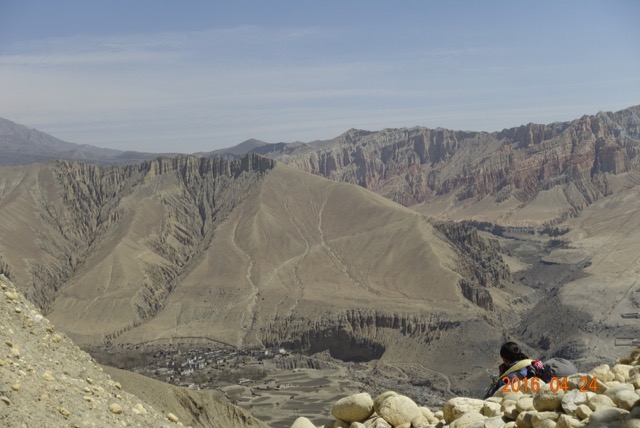
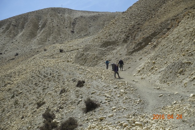
After a short stop for tea at Samar (elevation equal to the “top of the Burn”, 11,700’), we tackled another rise to lunch at Benha. While the food was forgettable, the bathroom was not. Mustangi dwellings are surrounded by a surfeit of scenery, so why not take advantage of it? The window over the squatting hole looked back to the Himalayan crest, just another ho-hum sight for the locals, but a recurring jaw-dropper for me.

treeladder-1

Walking out of town, I ticked off one of my “must-sees”. Peissel had always been taking a “tree ladder” up to the second and third stories, where the family and guest rooms invariably sit, above the animals’ quarters on the first. He never described them, so I was thrilled when I realised they are actually ladders carved out of a tree. Sturdy trunks are a rare commodity now, as the locals continually top their woods, leaving narrow branches jutting up from stout trunks. The wood is then piled along the upper eaves, to dry and be retrieved for fires. The past several years, cooking and heating oil has come into vogue, but the price must be too much for Mustangis, as all of the tea house kitchens featured a cast iron wood stove, doubling as furnace and cooking center.

stumptrees-1

The afternoon turned windy, and as we climbed even higher, into the cold. Clouds appeared as we descended into Ghiling (Geling). Widely scattered snowflakes started dropping on the track. Past the desolate entrance chorten, Chaim approached a single-story house, knocked, and got no answer. He pulled out his cell phone, but it was a half hour wait in the darkening evening before the proprietress appeared. Entering, we found an ceiling open in the middle to let smoke out, with guest room surrounding this interior courtyard. After dropping off our gear, I stepped outside, for another look at the developing alpenglow. Instead, I got a surprise visit from a few locals. As I gawked at the stark scenery, several of the town cows ambled over to the porch, and stood mooing, like cats asking for food.

Posted in Mustang, Travelogues | Comments Off on Rocky Road (Mustang V)

Up, Up, and Away

steelbridge

At 2729 meters (8930’) above sea level, Jomsom is roughly the same elevation as our home in Snowmass, Colorado. As we traveled the next two weeks, every now and then I would give Cheryl a reference of our elevation to the Snowmass ski mountain: “Jomsom is like the base of the Alpine Springs lift”.

While I don’t live full-time at altitude, I have spent enough time there over the past fifty years that I hardly notice the transition from lowlands to high. No headaches, nausea, or tiredness. The only concession seems to be a gradual slowing in my pace, the higher I go.

As a side effect of my triathlon obsession, I have a GPS watch, the Garmin Fenix 2, which provides me a dashboard of information sufficient to make an airline pilot envious. Altitude based on Global Positioning Satellites or barometer, thermometer, accelerometer, and a suite of built in algorithms to provide me with speed, distance, rate of climb, total climbing and descent, etc. (For a fuller description of this wrist computer, go here.)

So I know that on our first day, we walked 6.4 miles in 2 hours and 45 minutes (not counting rest, tea stops, and general dawdling for picture taking (Cheryl) or sightseeing (me.) Our total elevation gain was 870’, although Kagbeni is only 90 meters (300’) above Jomsom. Garmin records all this data, and displays it on the web with maps, charts and tables.

This trip is designed for gradual acclimation, so the second day was much like the first: 8.5 miles in 3 hours, 20 minutes, gaining 240 meters (787’) with 2536’ of total gain.

We started out the same as the first day – trudging up the river, stumbling over a crude trail mashed into the rocks. Powerful four-wheel drive “rock trucks” have slightly pulverized the river bed as they make their way up and down the Kali Gandaki. These vehicles are the ubiquitous work horses of the Mustang Valley. Moving at a stately 5 mph, they blast out Indian rock songs from their open air cabs, carrying workers and hauling rocks plucked from the river back to town. Without easy transport, or a local supply of wood, stone is the basic building material here. And there is plenty of it; all it takes is a strong back to load the trailer bed, and a capable driver to bring it in.

rock-truck-1

Since the river changes course frequently, there is no incentive to create a permanent route within the Kali Gandaki. So the “road” is often wherever the last truck came through. About a mile from town, the track led us out of the river proper, onto a steep bank about 10 feet up. A small settlement, not big enough for a name, guarded the small strip of flat land snugged between cliff and river. Chaim (our guide) moved confidently forward, but quickly came to a puzzling junction. The bank had grown to 20 feet over the river, just past an orchard and a stone wall, and the trail led straight down, as if the only way forward was to jump.

Never shy, he started talking with the man tending the trees nearby. While he conversed, we debated our clothing choices. It was getting warmer, but the wind was picking up. The best solution, I realised, was to convert my trekking pants to “shorts mode”, remove an upper layer, but add the all purpose Nepali headgear – the Buff. This is basically a muffler for the neck. It’s about 18 inches long, and can serve as a scarf to keep out dust and wind, a hat for the colder reaches, and a warming neck gaiter. From then on, I was never without it.

Chaim returned with his ever-present smile. “He says down there is only a local trail. Uh…we go back, cross the river on that little bridge.” He pointed to a narrow piece of driftwood lying on the rocks across the swift but shallow river. If you look carefully at the map on the link above, and zoom in on the squiggly portion, you’ll see the multiple back and forth we took to negotiate this obstacle. This would be almost the only time that Chaim backtracked. After fifty trips to the Mustang (so he says), he carries an infallible mental map of the region.

narrowkali

After passing through Chhusang for lunch, we headed out for our last kilometer on the river, At this point, the Kali Gandaki exits (we’re going upstream, remember) from a narrow red rock canyon. A giant slab of rock, the size of a Soviet apartment block, has fallen off the cliff face, tilting across the river to lean against the opposite canyon wall. The river is squeezed tight underneath the monolith; a steel pedestrian bridge takes us over to a precipitous trail leading up to Chele. It is here that Mustang truly begins.

entering-chele

South, below, down river from this point, the people are primarily Nepali in culture, language, and ethnicity. North, above, upriver, a Tibetan dialect is spoken, Tibetan Buddhism is practiced, and the culture, clothing and ethic appearance is all Tibetan, too. Even the food changes: barley for Tsampa, Yaks for butter to “flavor” the tea.

bluecheledoor

Chhusang and Chele are only a mile apart, a mere 250’ difference in elevation. But it seemed like passing through the looking glass. Chhusang bustled with horses, trees, a river confluence, lodges with hot and cold running water, signs denoting businesses. Chele was a monochromatic white, save for the brightly painted doors. Wood was piled along the edge of every roof, main walls and chortens popped up around every corner. Like a traditional Mustang house, our tiny room opened onto a third story roof top. I began to feel the slow moving magic of Tibet, even if only as a faint echo.

cheleteahouse

Posted in Mustang, Travelogues | 1 Comment

Kagbeni


kagbeni-1-1

The bells seemed distant at first – a faint metallic rattle filtering through the drafty window of our second story room. Just as the planes and airports had been growing progressively smaller and more primitive as we moved out from the cacophonous chaos of Kathmandu into the desolate plateau beyond the Himalayan crest, so too the accommodations. Hotel Tibet in the capital: wood paneled, luscious breakfast buffet; Pokhara lodging: spacious enough, but electricity only in the evening. Now in Kagbeni, not yet a tea house, but barely a hostel. We did have a bathroom of our own, but the toilet was attached to the wall by precarious plastic clips, the shower centered between the sink and commode, uncurtained and  splashing water on both. The hot water just a promise. Wooden floors lay below a threshold of exposed frame with a raised step-over, easy to trip across. The single pane glass windows had merely the suggestion of a curtain.

But the bells brought me up quickly. I looked outside just as the lead goats curved first right, then left just beneath the window. I pulled my camera from my pack, switched on video, and watched as the entire town’s entire population of nannies, bucks and kids waddled purposely up the stone passageway, heading out to the day’s pasture. Guided by several townsmen, they appeared to know the way. But it certainly wasn’t something I’d ever seen before, even in rural Colorado or Washington.

Seeing them gave me impetus to go out and explore the town. The sun was just coming up over the eastern ridge, highlighting sharp white peaks to our south. Beneath rock slabs which covered the narrow streets, water flowed in channels from the western snowfields into barley fields below, just now sprouting green shoots drifting in the morning stillness. Come afternoon, they would be a waving verdant sea, bending ever north with the incessant afternoon gales.

To my right out of the lodge stood a half-buried chorten. These monuments guard the entrance and exit of every town in Mustang. Bas reliefs depicting key moments in the life of the Buddha sometimes decorate the sides. The centers are arched pass-throughs, like a tunnel tree in the redwoods. Above, the bulbous tops are hollow. Relics are hidden in the onion shaped roof, remains of Buddhist monks or nuns, or maybe scripture fragments. In major cities and holy sites, they are called “stupa”, grand in stature and focal points for pilgrims.

On the lonely steppe in Mustang, these seem less linked to religion, and more as a “city limits” sign. This one in Kagbeni was half-buried, gradually being swallowed from below as the town grew and re-paved its paths. Just now, an older women in black thick wool dress, with bright multi-colored apron around her waist, was sweeping up after the goat’s passage. She’d throw a bowl full of water on the stony road, and make a stab at pushing the droppings to the side of the road. But she seemed more concerned about moving the dust around than actual public sanitation.

kagbeni-1

The evening before, we had gone exploring. Kagbeni is a hub for tourists, trekkers, and pilgrims. To the east, Indian Hindus head for Muktinath, a 7 mile walk or jeep ride away, with 3200’ of elevation gain. There, a site holy to both Hindi and Buddhist draws hundreds daily. We will visit there on the final day of our adventure. Also, this route is part of the famed Annapurna Circuit, a trekking classic mainly traversed by the young, as it can be managed without a guide. To the west lies Dolpo, another of Nepal’s many hidden valleys. Like Mustang, it contains remnants of Tibetan culture, with the locals practicing Bon, a precursor root to Tibetan Buddhism. And to the north, Mustang, where we are headed.

kagbeni-1-2

We push towards the northern perimeter, where we find a large squat red cube-shaped building; a monastery for sure, as they are are always plastered with this distinctive pigment. Below sits a mani-wall. Like the chorten, these appear along the main routes in and out of towns, as well as near monasteries. Long, stucco’ed slabs of rocks, with a covered alcove along the top. Within that space, monks insert a series of darkly stained cylinders, each a bit larger than a coffee tin, covered with writing which must be prayers. Inside, there is rolled up scroll, again filled with hand-written prayers. Suspended by a pole through the center, with stout wooden spokes sticking out from the bottom, they are meant to be spun while walking by, allowing the prayers within and without to be sent off into the wind, up to the sky and out to all the world. One must always pass to the left, spinning with the right hand. Much easier then going to church, or even praying five times a day on a mat, I think.

At the northern edge of town, we are stopped by a stern notice, hand written in English and posted outside the police booth, warning us that travel beyond is restricted to the north. This provides a chilling sense of apprehension for our walk through there tomorrow. We head back, and wander down to the river. Here at Kagbeni, the Kali Gandaki chutes through a narrow gap as it drops precipitously, almost a waterfall. The steep cliffs act as a funnel neck to the warm air being pushed up from the south. There is a steel suspension bridge over the gorge. In the middle, the wind nearly blows us up and over the slender supporting cable. Below, Indian ladies in saris with rolled up hems are stepping in the waters. Apparently, this is another holy site, and the ritual baptismal immersion is required of all pilgrims on their way to Muktinath. On the way back, they pause at tables where grizzled men offer saligrams for sale.

Posted in Mustang, Travelogues | 1 Comment

Riverwalk (Mustang Journal II)

riverbed-1

Jomsom Airport sits on a low plateau just west of the Kali Gandaki river. Both north and south, the riverbed spreads out nearly a mile wide, filled with rocks sized between walnuts and melons, brought down from the barren Himalayan summits by the rare but torrential rains which manage to leak past the Annapurna/Dhaulagiri crest bisecting the town.

Those highlands were once a seabed, and if you look carefully as you step, you may find a dark stone, standing out from the lighter grey mass of variegated gravel. Picking it up, if you see a spiral image embedded within, you have found a Saligram.

Western scientists have labelled, classified, and dated these fossils as being from 150,000,000 years ago, an ocean dwelling, now extinct creature, called an Ammonite. Although similar in appearance to the Nautilus, they are actually more closely related to the octopus or squid. The spiral ribbed shell is what gives them their distinct and pleasing appearance.

But Hindus of Nepal and India worship them as the physical manifestation of the god Vishnu. And Buddhists see them as blessed by the female sky-dancing Dakinis, who carry the souls of the dead to the sky. So our guides spend much of their time walking north on the riverbed out of Jomsom, heads down, picking up and discarding fist sized and smaller dark rocks, examining them carefully for the presence of Vishnu. The spiritual connection is somewhat vestigial, though, as good specimens specifically from the Kali Gandaki can go for anywhere from $100-1000 when exported to the west.

The land has been folded back on itself several times as the Indian sub-continent pushed north under the main bulk of Asia. The cliffs abruptly rising from the flat rocky surface of the river reveal this tectonic corrugation. In some sections, the many layers of ancient seabed are level, stacked neatly on top on one another. In others, the land appears to have been tilted a full 90 degrees, then folded like an accordion.

kaliclif-1

In places, the occasional monsoon rains have washed away the softer dirt surrounding the rock, and left red hoodoos, looking like abstract statues made of aggregate concrete.

hoodoos-1

In the midst of the dry, lifeless land, we pass by several settlements, their irrigation fed greenness standing in sharp contrast to and defiance of the harshness all around. All about these small towns, terraces sprout, farming plots for local staples such as barley, tubers like carrots and potatoes, and apple trees. After walking over the river stones for two hours, we stop at a teahouse snuggled between the cliffs and river.

terrace-1

Chaim, our guide, asks me if I’m ready for lunch. Well, why not? He produces a single page menu. The only thing I’ve heard of on the list is “Dhal Bat”, so I go for it. This staple of the Nepali diet is a catch all term, meaning, “rice, maybe some bean slurry, and whatever the cook has around and wants to heat up.” It’s either delicious, or I am famished, or possibly both. Accompanied by lemon/ginger tea, it both fills me up, and has me ready to face another walk, to Kagbeni, about an hour away.

Posted in Mustang, Travelogues | Comments Off on Riverwalk (Mustang Journal II)

Ironman Maryland 2016

After this race, I’ve got a new coach. No, I’m not replacing EN, but if Rich and/or Patrick aren’t around, I’ve got a great substitute – my wife, Cheryl. She completely turned my race around in the middle of the run.

The day started with improving weather. Of course, all things are relative. The Eastern Shore had been pounded with multiple storms the preceding three days. On the totally flat countryside, the rain had little choice but to turn the marshes completely boggy, over-running part of the bike course, shortening it to somewhere around 102 miles. Winds had been whipping down the Choptank at 10-20 mph, with gusts as high as thirty, stirring up white caps, and reversing the expected current flow. Race morning was dry, though cloudy, air temp at 67F and the water at 71. To my eye, the surface was fairly smooth – less than six inches of chop, no whitewater visible.

Walking into transition at 5:45 AM, we slogged through about three inches of water, apparently from a coastal tidal surge. The race director was telling everyone who entered, “Yeah, you’re getting a little wet now, but I promise it’ll all be gone with the tide by the time you go out on the bike.”

2000 expectant triathletes lined up behind the blue arch, filling the space between the seeding signs. I aimed for the middle of “1:10-1:20”, getting there about two minutes before the 6:45 start. Immediately, I heard a crackling from the PA, and someone said, “OK, here it comes.”

“The conditions are just not favorable at this time. We will be delaying the start until 7:15. We’re sorry, but athlete safety is paramount…” I strolled over to the water’s edge, and stared out across the river. Bear in mind, this is no ordinary river. It’s miles wide at this point, a tidal estuary spilling into Chesapeake Bay. The wind flowed in from the East, at about 7-8 mph. Flags whipped at shoreline, but the kayaks and SUPers easily rowed out to the race course. I warmed my hands on a generator, and shared my confusion with the other racers huddled there. We agreed that we’d raced in worse – Lakes Coeur d’Alene and Tahoe immediately came to mind – but that with the persistence of swim leg deaths over the years, WTC really had no choice but to place the safety of the “bottom ten per cent” over the competitive desires of the “upper ten percent”.

7:15 came and went, and with it the inevitable swim cancellation. I proceeded into my slowest T1 ever. With a relatively low number (442), I had an hour between stand down and roll out. Racked next to my toughest competitor, Pat Peppler, I had an opportunity for a little trash talk. At our age, that consists of polite support and commiseration, apparently. I went over how I might alter my ride, based on no swim and 10 miles less to bike. I decided to place more emphasis on heart rate, aiming to keep it in the low teens until the last half hour, then let it ride up towards 120. The run would then proceed in the upper teens.

Out on the bike course, that’s exactly where I ended up. Overall average, moving, and pedaling HR was 112. My 20 minute intervals were all either 111, 112, or 113. VI on this totally flat course was 136/132, or 1.03, which strikes me as pretty poor, considering there were literally no descents of greater than 1′ or 0.5o % grade.

For nutrition/hydration, my total fluid intake was 60 oz of Infinit over the 5:10 ride. Even that minimal 12 oz/hour had me pee’ing sometimes every ten minutes between hours 1.5 and 3.5. Added to those 800 calories were 400 from Clif Bars, and 300 from EFS gel, a total of 1500 or 300 per hour. Side note, of some import to me – this was the first time, ever, racing or training, that I had been able to pee while riding. I think the several rain showers we had over the course of the ride helped a bit? Old dogs can still learn new tricks, I guess.

I kept expecting Pat to overtake me, as he had a history of faster bike splits than me. He never showed up, and when I returned to the rack, his bike wasn’t there, He still hadn’t shown up when I ran by 5 minutes later, so I said, “Hmmm,” to myself, and lit out on the run. I started clicking over the miles at 10:15-10:45, and felt pretty good through the first 10 miles, especially considering the dew point and temperature were both peaking at 80.

At that point, in downtown Cambridge, with the finish line on my right (I had a couple more loops before I could get there), and a turn-around about a mile ahead, I noticed runners splashing through a giant puddle. Now, I should point out that I try assiduously to keep my feet dry during a run, hoping to avoid blisters and trench foot 
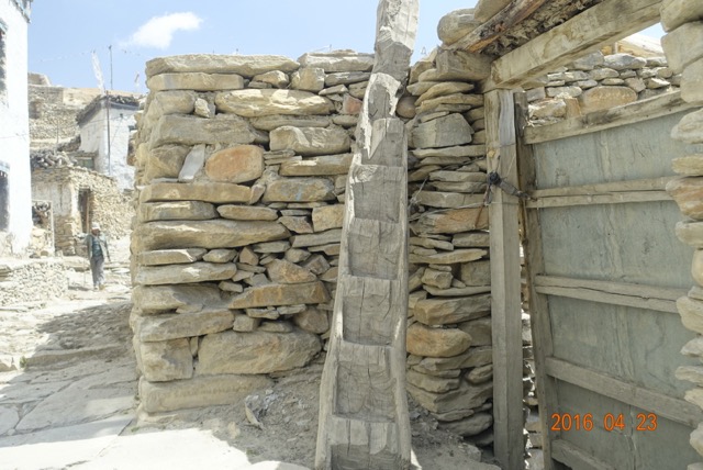
. This made me angry  for a few moments, but there was nothing for it but to wade through. Even the sidewalks, six inches above the road surface, offered no respite. I did a high-stepping run for about two minutes, coming out the other side. Ten minutes later, of course, I had to slog back through it after the downtown turnaround. I didn’t quite register at the time, that, with two more lakes forming, there would be ELEVEN total trips through this “coastal flooding”. Some of it was literally flooding direct from the Bay/River; others were due to backed-up storm drains. After running the first two times, I realised that letting myself walk a bit in the deeper parts was really not much slower, and gave me an excuse to look forward to slowing down momentarily.

After the start of the second loop, just after mile 12, a new puddle had formed at the exit from transition. As I tried to start running out of that morass, I began to mentally fall apart. I was ready to walk. I was feeling gone in my head, almost dizzy. Faint-hearted and faint-headed at the same time. Cheryl appeared on my right. I said, “I don’t know, I don’t feel so good. I’m not sure about this.” Mind you, I wasn’t slowing down, and I was well-nourished and well-hydrated. I had been taking diluted GE at each aid station, walking from taking the cup to finishing it, and actually pee’d once about mile 8. Just: something didn’t feel right in my head.

She took one look at me (she’s seen me in maybe 25 IM runs, so she may have a better read on how I’m doing that I would), and said, over and over, “Eat something. You’ve got this. You need to eat something. You can do this.” She’s never given me advice before, and she said it so assertively. I didn’t have any other plan, so as an aid station was coming up. I walked into it, found a cookie and cup of Pepsi, and slowly went to work. That mile was 13:00, and my HR dropped from the high teens to low 100s, but my pace picked up along with my HR over the next 20 minutes, while I took on board another cookie and cup of cola. My mood and attitude improved, and were buoyed by seeing other EN supporters – Scott Dinhofer, Danielle Santucci – along the way. I realised that while I was quite capable of letting myself down in a race, I was incapable of facing them if I stopped running, not after all the biking and running we’d done together earlier in the year.

With the puddles getting longer and deeper, I couldn’t did get my mile times back into the low 10’s, but I did keep running, and felt stronger as the afternoon went on. I never did delve into my trove of One Thing mantras, managing to power the run without them.

Overall, this was the most satisfying IM I’ve had since 2013. I felt the 3000 miles I’d biked, and the 500 miles I’d run since early May had been honored, and I had let neither the bizarre conditions, nor my mysterious mid-run breakdown torpedo a successful race. As I tell others, it’s always a success in an Ironman when you run the whole way. Keeping my bike steady, 0.5 mph faster than I’d planned, and keeping my run (at least outside of the lakes) in the 10s added to that feeling of accomplishment. Looking back at my race plan, my goals had been: “I have the primary goal of being satisfied with my performance at the end of the day, and the secondary goal of meeting my process targets.” And: “I have to demonstrate to myself that I am willing to actually race to the limits of my capabilities, whatever they may be at this time and at this age.” It’s the rare race when I feel completely satisfied at the end; out of more than 100, I can count them on the fingers of one hand. This is one of those. Only one was a win (IM CDA ’09); the others were 6th (Capitol City HM ’03), 4th (IM Moo ’05), & 6th (IM AZ 2013). In Maryland, I ended up 4th in my AG on the day, but first in my own accounting.

Posted in Races, Triathlon Central | 4 Comments