“This topography is … breathtaking, “ I wheezed.
We were trudging along at about 8500 feet above sea level, on the Inka Trail. While the thinner air might have had a little to do with my breath being taken away, I was really stating my awe at the endless precipitous crags surrounding us. Two days earlier, we had been driven from Cusco (11,200’) over a 13,200 foot plateau into the sacred valley. At the latitude of, say, the Colorado Rockies or California’s Sierras, we would have been surrounded by naked rock, looking down on timberline. Here in the foothills of Peru’s Central Andes, however, we drove through lush farmland, green from the summer’s rain.
Known as the plain of Anta, this fertile tableland separates the Inkan (and later, colonial) capital of Cusco from the Urubamba River valley. Potatoes, tarwi (edible lupin), barley, and quinoa all respond well to this warm, well-watered high altitude agricultural environment. It’s probably a major reason why the Inkas chose Cusco as their chief city.
The town itself is supposedly shaped like a puma, with the oldest portions being near the haunches. Truly narrow, cobbled streets, walled on either side by 600+ year old foundations of smooth rock fitted without any mortar or space between them, were once walked by the ancestors of today’s “indigéns”, later by the Spanish conquerors, and now plowed by an endless stream of honking micro cars. The Spaniards basically razed the buildings down to those 3 meter high foundations, re-arranging the buildings’ stone work into European necessities such as cathedrals and churches. There are at least 10 within a half mile walk of our hotel, which itself sits in a colonial open courtyard hacienda, covered now with panels of plexiglas.
As we careened down nearly 6,000 feet into the Sacred Valley of the Urubamba, the deep green growth gave way to scrub land and even a few cacti. Across the valley, the higher, glaciated peaks of the Andes peeked through slot canyons leading up from the towns of Urubamba and Ollantaytambo. There, we would meet up with our train into Aquas Caliente, jumping off point for Machu Picchu.
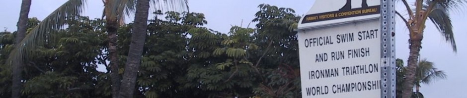
The narrow gauge tracks follow the river, named Urubamba by the indigéns, and Rio Vilcanota by the Spaniards. No road (except for the Inka Trail, along the ridge above us) leads from here, meaning everyone who goes into Machu Picchu takes the train. There are three choices: the cattle car, into which backpackers and the local population cram; the PeruRail standard, which is a series of four seater tables with overhead viewing windows; and the Hiram Bingham.
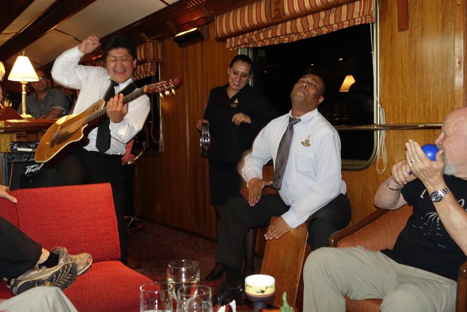
For twice the price as the standard PeruRail train, you can take the Hiram Bingham, which goes into the valley each morning, and leaves late each afternoon. Authentic 1920s Pullman cars, with superb dining facilities, a bar car, replete with almost as many staff as passengers. A truly plush experience, befitting this once in a lifetime trip for many of us.
During this tail end of the rainy season, the trip is shortened by about an hour – we miss the upper, drier valley and the views of the high altitude farms. But the deeper we go along the river side, the lusher the plants become.
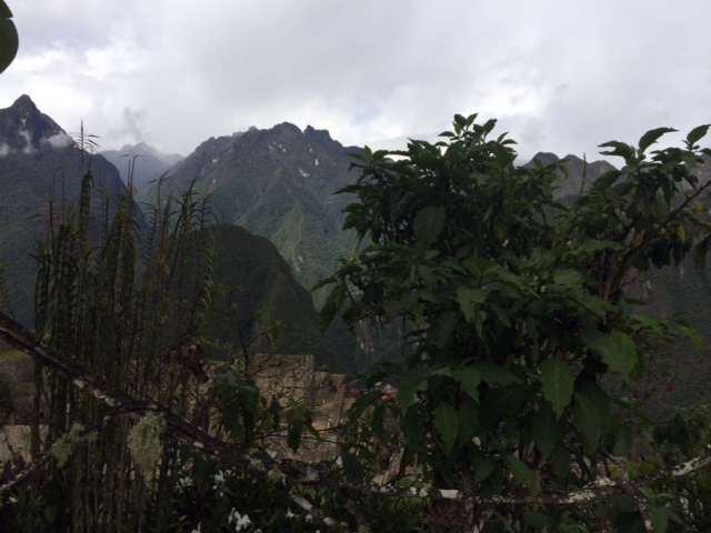
“This is what I thought Machu Picchu would be like,” I said.
“What do you mean?” Cheryl countered.
“Well, I had always thought of it as a cloud forest – you know, almost like a jungle or a rain forest, a lot of vegetation. Look up – see how steep those mountains are? You can see rock faces in some places, but, most of the time, the trees and ferns and vines and everything are just clinging to the sheer face. Like Patagonia, I guess, but with the rocks all covered by green.”
Disembarking in Aguas Caliente – also known as Machu Picchu Pueblo, we are met with a constant rattling roar, even after the train has moved back up the tracks. Aguas sits at the confluence of the Urubamba and two other creeks, both of which are hurtling madly down from the highlands above where Machu Picchu proper sits. The noise surrounds us constantly; our hotel sits at one end of town in a relatively untouched portion of the forest, hard by the river and one of the tributaries. Even with the windows closed, it sounds like breakers at the beach.
It would even crowd out any traffic noise, were there any. But Aguas, with no roads in or out, has no cars, Everyone, tourists, locals, everyone walks anywhere they want to go.
“Why is every street named ‘Via Escape’?” Leigh queries.
“Yeah, I’ve been noticing that. I see that at many of the roads leading uphill away from the river. I think it’s like an escape route when the flash flood warning is sounded,” I return.
“Why would there be flash floods?”
“Well, look up.” The tops of the canyon walls – for we were in a canyon, just one covered by trees, not like the dry sandstone walls more common to the Colorado Plateau – were misted over. “Those two gullies running into town carry the water from those mountains all around Machu Picchu. I bet it rains a lot more up there than down here, and when it does, it can raise the river up real fast, you know. So it’s like the signs we’re starting to see along the coast, ‘Tsunami escape route’, or the “Lahar escape route’ we have in Puget Sound.”
“Lahar?”
“Yeah, that’s what they call it when the volcano erupts and a massive mudflow maybe with some lava comes down the Puyallup River.”
We kept on walking through town, to the central plaza; all Spanish colonial towns throughout Latin America have them. Usually they are a respite from the traffic and noise the automobile has made universal. But in this town, it was simply more of the same – people walking. Off to one side, a platoon of gendarmes was doing some close quarter drills. A fountain in the center spewed water into a trough, where a father washed the remains of lunch from his son’s hands. The sun shone with a bit of intensity, but the moister air kept us comfortable. It seemed a place worthy of an empire’s interest.