Our room looks out over the stone path which runs along Lo Manthang’s eastern wall. With daylight comes the shuffling, clacking sound of older Mustangis, twisting prayer beads, heading towards the mani walls outside the monastery. Their prayers are hummed, a mumbled sound like flies buzzing circles round my head. Wrinkled grandmothers brush dust away from shop entrances, using brooms made from bundles of thin stiff reeds tied together with multicolored fabric taken from the end of a hand woven apron. Young men dressed, unlike their elders, in blue jeans, athletic shoes and western winter Holofil jackets, urge goats and horses out from the city towards that day’s field. Their hooves clatter on the stone, and their breathing melds into a chorus of snorts and wheezes.
Across the Plain of Prayers, the sun angles weakly over distant hills, setting off ground fog rising from the nearly frozen earth. In the yards across the way, I notice piles of rock – free and plentiful – mixed with timbers (much more precious), ready to be assembled into houses where fields now bristle with last year’s crop of barley stalks. More young men, shoulders hunched against the chill, gather themselves into a construction crew. They are joking amongst themselves, I assume, as laughter ripples up.
Today, we’re going to Choser/Garphu. Chaim and the Honor Man have arranged horses, so we can “rest” after five days of walking. I manage a couple of miles stuffed onto the wooden saddle, but find walking a bit easier on my nether parts and knees. As we roll into the morning tea stop at 10 AM, a clutch of pre-teen girls, talking and giggling, walk up behind us. Cheryl smiles and asks, partly in sign language, if she can take their picture. Surprisingly, the tallest answers in English.
“Where are you going?” Cheryl queries.
“School.”
“What are you learning there?”
“We learn English, Tibetan, Nepali. We study maths. We learn about history of our country.”
The school is right next door to the tea house, and even though there is no bell, and none of them has a watch, they know classes are starting, so the photo shoot is cut short while they skip ahead. Apparently, school starts at 10 AM and runs to 4 PM, allowing time for morning and evening chores, as well as the 1/2 hour walk to and from their homes.
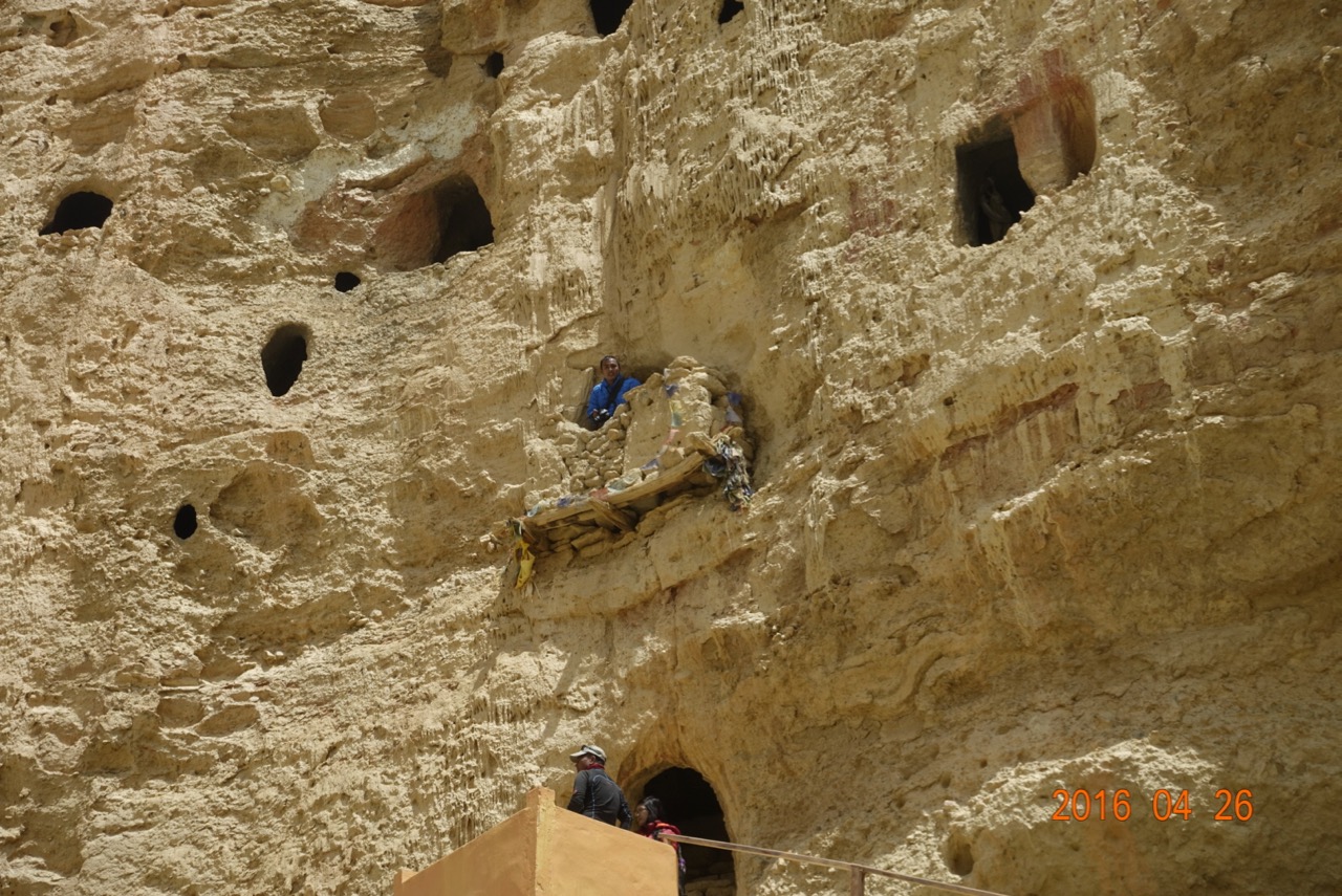
Back on the horses, we head up a side canyon, towards one of the the local attractions, a cave only recently abandoned. After a climb up newly built concrete stairs, we enter a maze of rooms, carved mostly by the wind, but some further hollowed out by human hands. None are large enough for me to stand in, but Chaim, 10 centimeters shorter, manages just fine. There is a lot of climbing up and down ladders, squatting through rock windows, and wondering how and why anyone would be living here. But there is room for an entire clan in the warren of cool, dry cavelets.
Back outside, the noon sun highlights red rock flutes and hoodoos lining the river bed we follow to the next stop, a cave gompa. Centuries ago, monks began using a hollow space in the cliff for their monastery, and built a fourth wall to protect it from the elements. Inside, the chapel follows the standard gompa pattern. But the paintings are done directly on the rock walls, curves and striations of the sandstone.
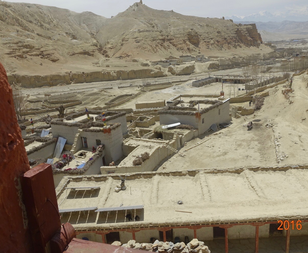 The Key Man tells us all the monks are today en route from Jomson to Choser via Mahindra jeep, coming back to work on building their new quarters, plant the summer crops, and re-commence religious training. The new quarters are a one-story dormitory, sitting just in front of more traditional two- and three-story homes. Yet even the older buildings have tin roofing lying on top, ready for installation, as well as solar panels and fresh water storage tanks. They are off the grid, but not without power. Soon, we’re assured, a cell tower will appear.
As we head down valley for our three hour ride back, we pass through a sudden splurge of green, grassy shoots fed by a stream tumbling from the mountains sourrounding us on three sides. We are at nearly 4000 meters (13,200’), yet the snow-capped peaks all around rise to a high point of 6235 m (20,450’), with the ridge mostly 1000 meters below (17,000’) On the other side of the ridge line is China/Tibet. The low point, Kora La, represents the easiest crossing from Nepal to Tibet. The rutted gravel double track road recently completed by Chinese engineers tops out at at 15,288’.
For centuries, this route was a foot-and-horse path, the “Salt Road” across which traders brought that essential mineral from the Taklamakan desert in what is now northwest China, down to India, in exchange for spices and seashells. Now, the Chinese are hoping to influence Nepali affairs by re-commencing trade. But the road appears deserted, and the only sign we see of that influence is a profusion of Chinese toilet paper in the local shops. Indian and Nepali goods otherwise predominate.
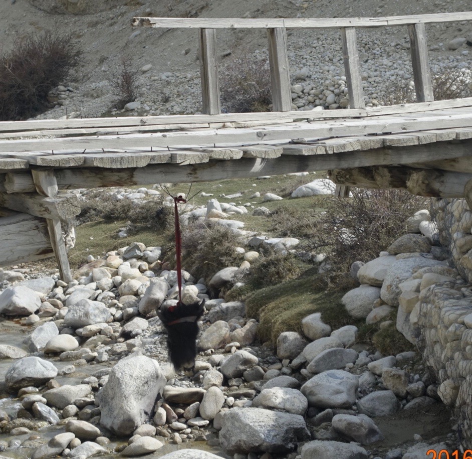
We follow the Nyichung Khola river valley back to Lo. We cross a side stream on a suspect wooden bridge. Local travelers must feel equally uneasy, as they have suspended a goat’s head beneath the timbers to appease any evil spirits who might have designs on the structure.
1 Response to Lo Manthang: Sights and Sounds