
“I only find one horse, for Cheryl,” Chaim announced at breakfast. “Al, you are OK walking? Maybe we go 9, 10 hours today?”
That was just fine with me. I was surprised by how vigorous I felt after ten days of trekking up and down the barren river gorges of Upper Mustang. I was no longer aware that our elevation had been around 3800 meters (12,467’, basically same as the high point at my Snowmass ski area, the top of the Cirque lift). Despite a broken toe five weeks earlier, I had no pain, no hitch in my giddy-up from walking about eight to ten miles each day. And I certainly wasn’t bored. I was getting into it, really, sort of like training for an Ironman, and today would be the final test. From the map, it looked like at least 14 miles, reaching the high point of the trip, 4260 meters (about 14,000’, nearly the summit of Mt. Rainier.) I was raring to go.
Cheryl would not be riding the whole way. The horse man would meet us at the base of the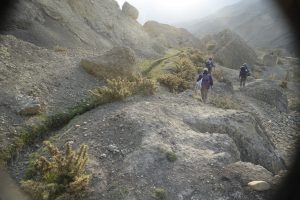 first climb, about a mile up the river gorge. First we followed a narrow line of green gouged into the hillside out of town – the hand-dug irrigation ditch, bringing water’s life-blood into Tangge. Unlined, the water seeped into the adjacent soil, and vibrant little plants followed its course all the way from the high glacier runoff.
Looking down to our left, I saw one of those rickety plank bridges across the river. A 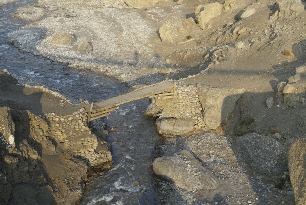 shadow arced just beyond it, with two figures shimmying along – the Spanish couple crossing high above on a narrow suspension bridge. A good reason for the horse not to take us right out of town. The other good reason was the equine effort involved in simply carrying Cheryl’s 50 kilos (the horseman took her pack) up the mountain side. Apparently the little pony needed all the energy he could spare for that. The route was as unforgiving as any we’d
 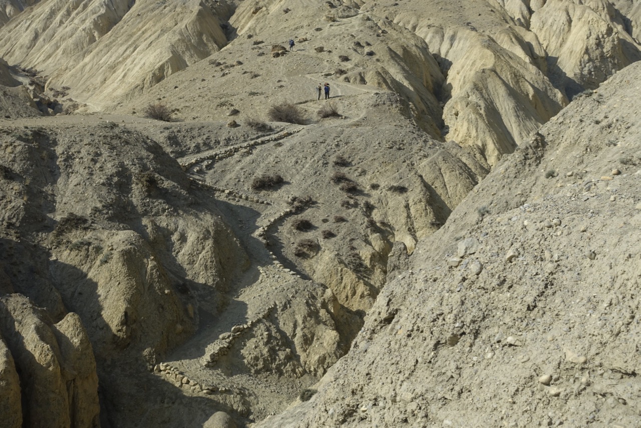 done thus far. Not exactly straight up the hill, but close enough. At least the locals had differentiated the human route from all the goat paths with rocks marking the edge of the trail.
It became obvious why the day would be so long. No villages at all in this part of Mustang. The small outpost of “Pa” proved to be a simple stone hut, uninhabited, next to the only water source we’d see all day. Nomads camped in the stony field below, their canvas tents darkened by the sun. Neither they nor their herd was in sight while we stopped for a morning do-it-yourself tea, meaning gatorade and nuts for me.

I walked 2600′ in 3 miles uphill; it took me two hours. Resting at the La, I saw Cheryl on her pony, bobbing along below. Ten steps, rest. Eight Steps, rest again. The horse was having issues with the altitude and cargo, and insisted on taking his own sweet time. Cheryl was laughing at the pony, pleased with his instinctive self-preservation.
Next came 8 miles across an arid, expansive plateau. At times we clung to the edge of a knife ridge, looking down and across to our left at the high peaks of the Nepalese/Tibetan border. The view in that direction seemed to mimic, at its very top, an Alpine panorama, leading down into the Black Canyon of the Gunnison, ending with a simulacrum of Bryce Canyon. The other side, the one we were walking across, had portions where the trail disappeared into a treacherous scree field. Cheryl and I took our sweet time getting through that stretch, as one slip meant a fall of about 1500′ through a jagged rock field. Chaim brought up the rear, ready to snatch his client from any danger she might tumble into.
The plateau, when it wasn’t scaring us silly with its drop-offs, provided a complete view of the entire Upper Mustang canyon lands. It was fun picking out the vague green patches surrounding the towns we’d been through on the other side of the Kali Gandaki, the week before. The previous night’s snow fall added luster to the high peaks on the Tibetan border ridges. On the other side, a vista of badland fins and deep canyons concentrated my mind on the steps I took.
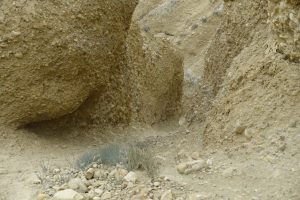
I kept expecting the trail to start its descent, but that was all wishful thinking. Around every bend was another; after every little rise a brief downhill, then back up again. Finally, the trail seemed to end in another maze of hoodoos and fins. Two gullies presented themselves; one must be the trail, the other simply a gash in the hillside. Both were filled with gravel, pebbles, and small rock, covered in “mud”, which is what Chaim called the ever-present dust. I was stumped, and found it impossible to decide which was the trail and which might lead to a precipitous drop-off. Could you choose between these two?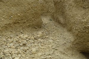
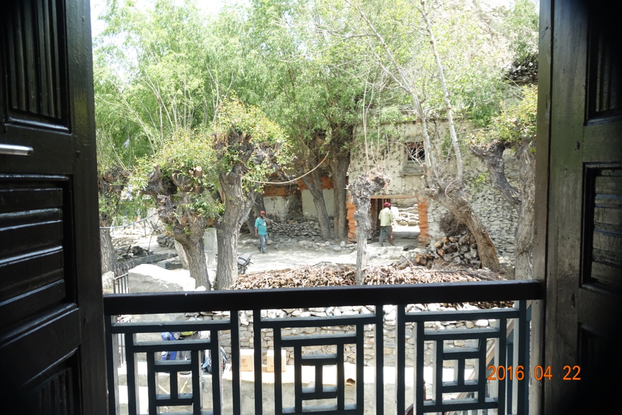
To end our day, we dropped down 3000′ in 3.5 miles, much of it taken “slowly, slowly”, making sure of our purchase on each and every step, leaning on both trekking poles, for fear of sliding through the pebbly dust. But we made it to Tangge, arriving at what turned out to be a familiar tea house. Our second day out, we had stopped for lunch at this same two story stone lodge, set beside a stream with full-leafed trees. We had not noticed the building out back, where that night we would find our first indoor hot water shower in nearly two weeks.
3 Responses to The Longest Day